There are three parts to this post, the first deals with the history of the area up until 1938, the second the clearing, demolition and eventual development of the park and the third and final part details each street in turn.
- Part one – Growth (1700 – 1938)
- Part two – Demolition (1938 -1968)
- Part three – The lost streets of Weavers Fields
Demolition and renewal 1930-1960s
“The whole of western Bethnal Green was scheduled for redevelopment under a 5-year plan for 1962-7, the southern part for industry, relieved by an open space called Weavers’ Fields around Mapes Street”
(from British History Online)
The Tower Hamlets archive holds a number of files filled with correspondence and drawings detailing the clearing and development of Weavers Fields. Much the information here is drawn from those files.
These are fascinating documents, filled with personal notes, annotations and asides. To recapture this era of local authority bureaucracy and drawing offices I’ve reproduced some of the actual documents. You can almost smell the tobacco filled council offices.
The idea to clear the streets and replacement with a more modern housing development seems to have been first discussed in 1938.
However any plans were paused due to the outbreak of war.
(reproduced with the permission of The Tower Hamlets Local History Library and Archives).
Discussions began again in 1953, Some of the properties had been damaged by bombing, whilst the whole area had continued to decline and (according to the local authority) become unsafe and unsanitary.
The LCC Medical Officer of Health reported –
“The Menotti Street Areas were represented to the committee in 1938, but the outbreak of war prevented the making of the necessary orders. The areas are included in the draft slum clearance programme for action by the Council during 1952 and a formal representation by Dr. J.C.P. Grey in respect of 153 houses and five “other buildings” contained in six technically separate areas covering approximately 3.9 acres is now submitted.
The principal defects of the houses concerned are bad internal arrangement (absence of through passages and some living rooms being underground), sanitary defects (dampness, undersized rear yards, inadequately lighted and ventilated rooms and staircases, water supplies and sanitary accounmotation being not readily accessable, the absence of food storage and washing facilities), and disrepair (bulged, settled and fractures main walls, defective ceiling and wall plaster, weak and settled floors, defective and rotted woodwork and much general dilapidation).
The five other buildings are included as being so arranged in relation to the dwelling houses in the areas to be dangerous or injurious to the health of the inhabitants of these houses.
Signed J.A. Scott.”
The Architect’s department of London County Council noted in 1954 that
“the area is of interest as showing the growth and development of the weaving industry in the neighbourhood and contains many examples of early 19th century weavers’ houses of which architectural records will be necessary for the Survey of London before demolition”
Whilst a rather jaunty response to the plans was added by The Inspectorate of Ancient Monuments and Historic Buildings –

(reproduced with the permission of The Tower Hamlets Local History Library and Archives).
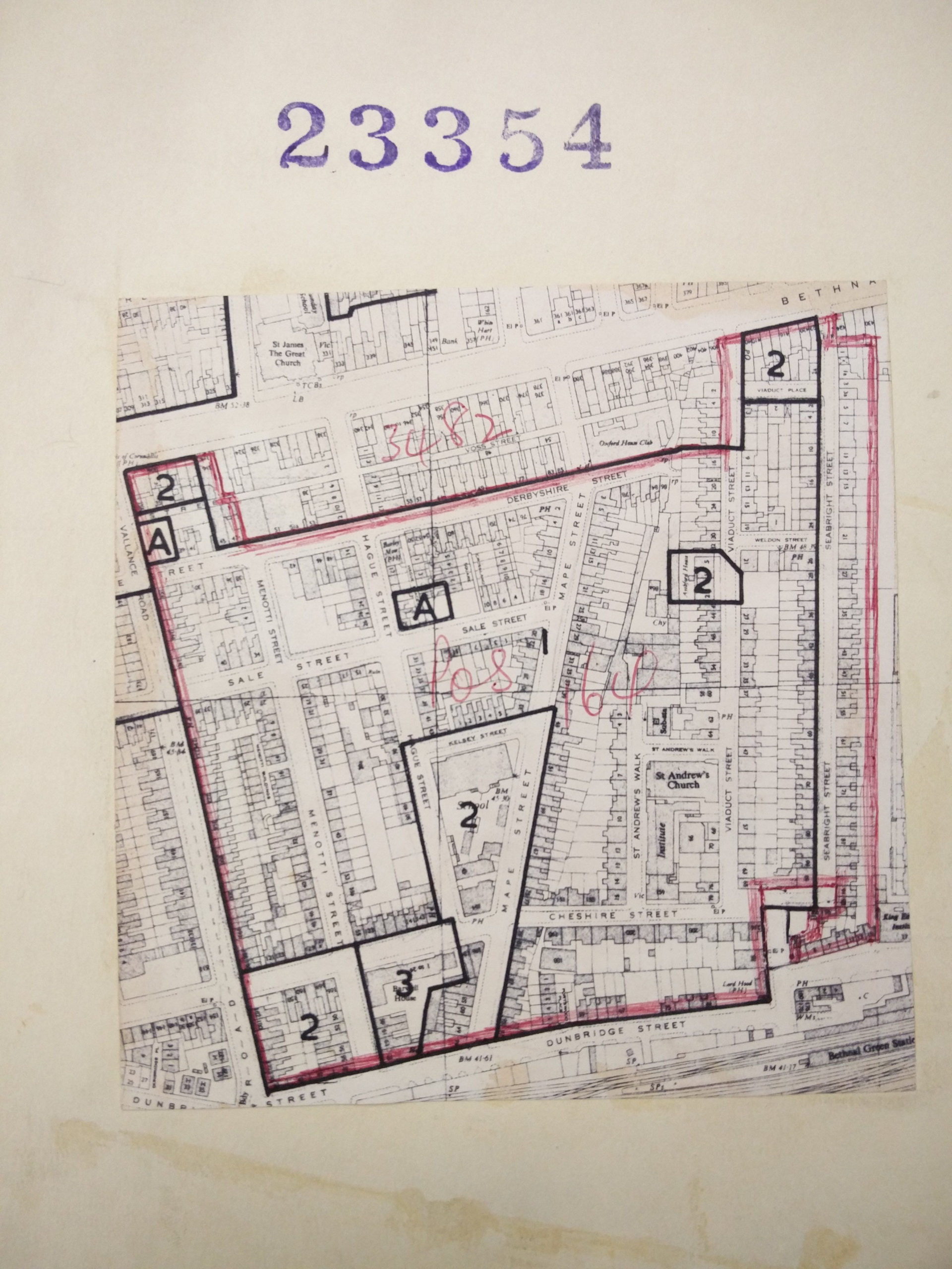
It was agreed that the area be cleared, seemingly in two phases, one centred around Menotti Street and the other around Viaduct Street. The eventual use of the land was discussed as being both for modern housing and an open space.
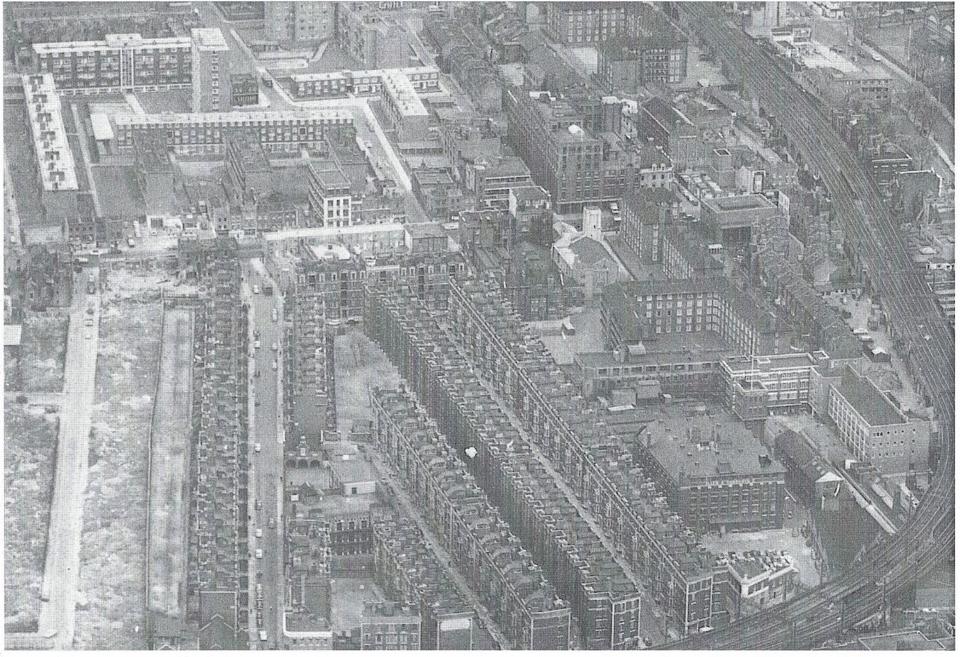
In total this area included 9.7 acres with 252 houses, 12 shops, 8 factories plus various workshops and garages. In 1954 it was agreed that acquisition of the properties would begin. It took over ten years to complete the compulsory purchases, closures of roads and the eventual clearance and creation of the park in 1967.
Meanwhile some roads to the west of Vallance Road (namely Abbey Street, Ramsey Street and Hereford Street) were cleared and reconfigured to make way for the Hereford Estate development.
Over those years various schemes were discussed, including the idea below of building tower blocks on the northern (Derbyshire St) end of the land.

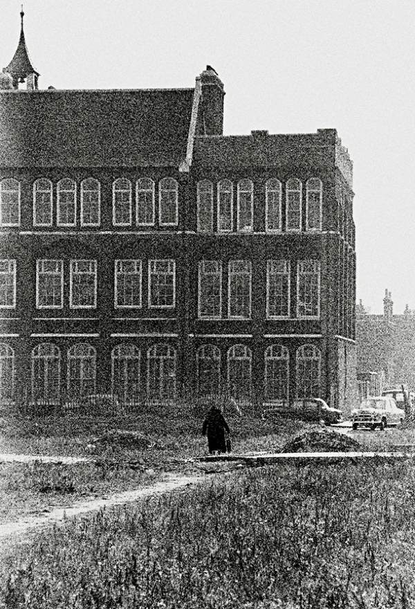
By 1957 attention turned to Saint Andrews Church on Viaduct Street. The London Diocesan pointed out that since the death of Rev. P. H. Beale the Parish could be merged with that of St. Matthew and the Church closed.
The Architect’s Department once again weighing in that –
“It would seem that from civic design point of view [the] church has little value – if I remember your views correctly”
With a fantastic missive at the bottom of the handwritten note stating –
“PS I don’t like the tenor of the parcel 5 of the housing / planning meeting 24/10/57 one little bit!!”
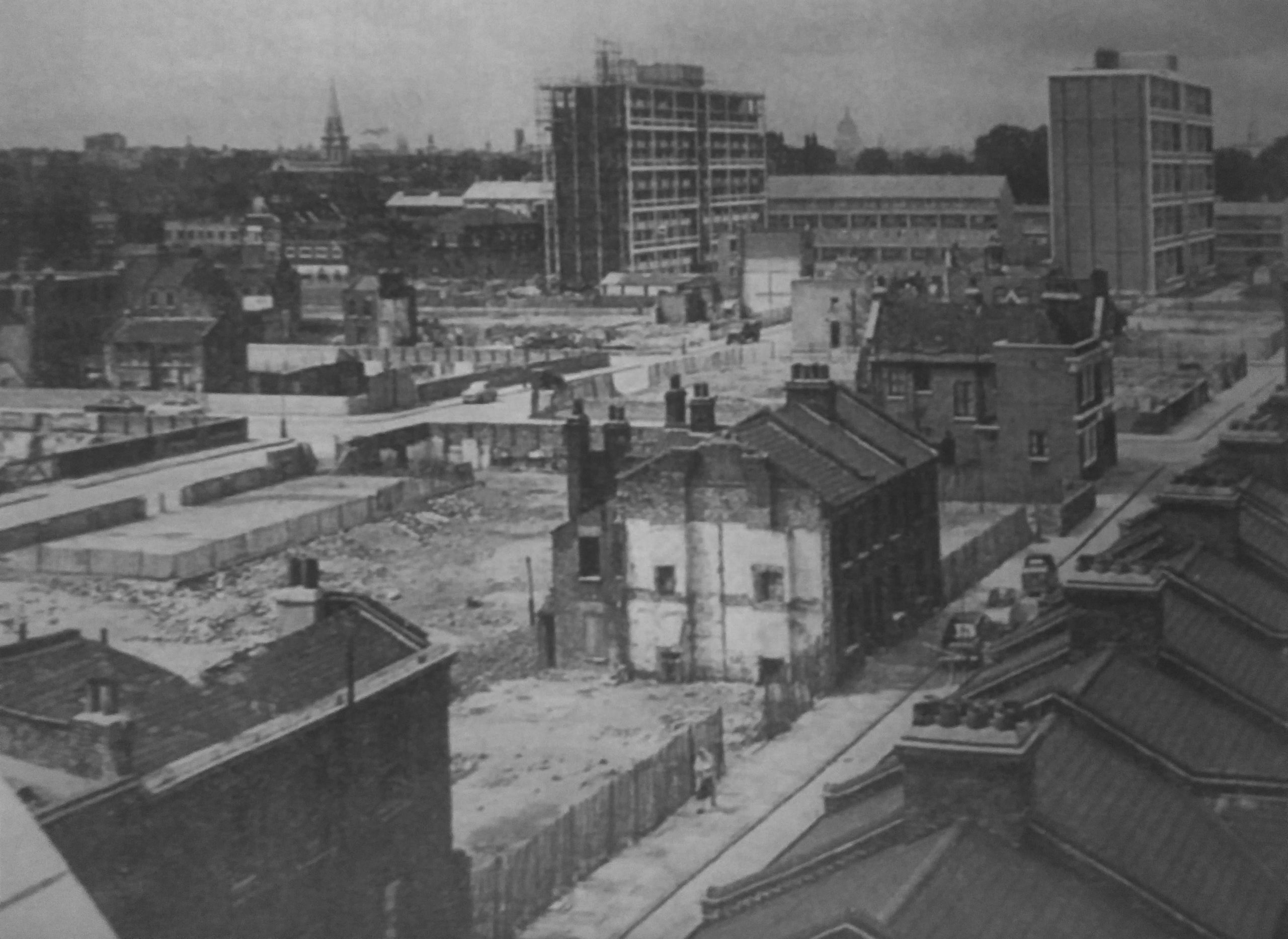
The plans were formally approved in 1958 and it was agreed that the entire site would be converted into an open space rather than housing. Clearence continued as detailed in the following article from The Times –
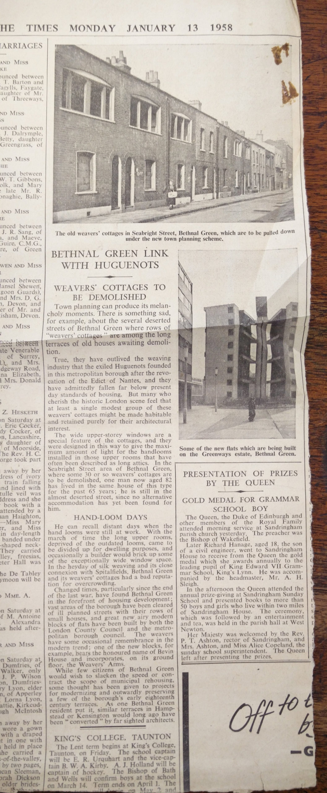
(Note an early photograph of Denys Lasdun’s Sulkin House just behind Roman Rd).
(reproduced with the permission of The Tower Hamlets Local History Library and Archives).

(reproduced with the permission of The Tower Hamlets Local History Library and Archives).

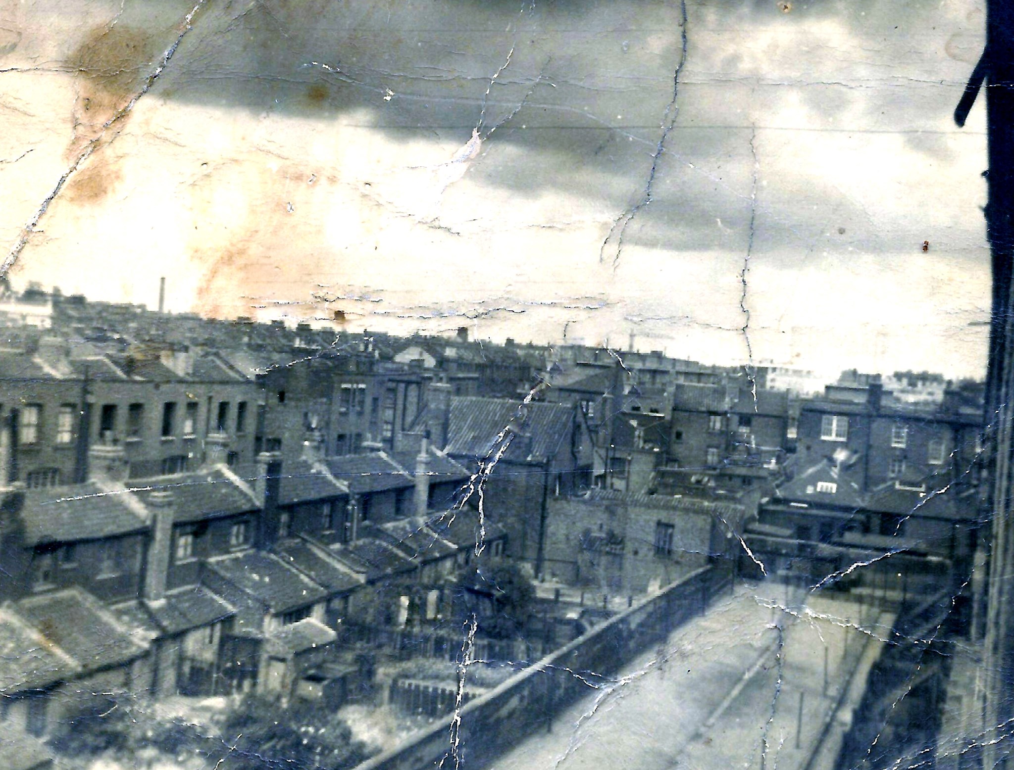
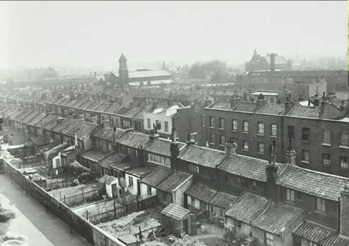
Weavers Fields on the left, note that Seabright Street was still present, even if the houses had gone.
The name “Weavers Fields” first appears in correspondence starting 1965, and it seems much of the work was by now in the hands of the Parks Committee.
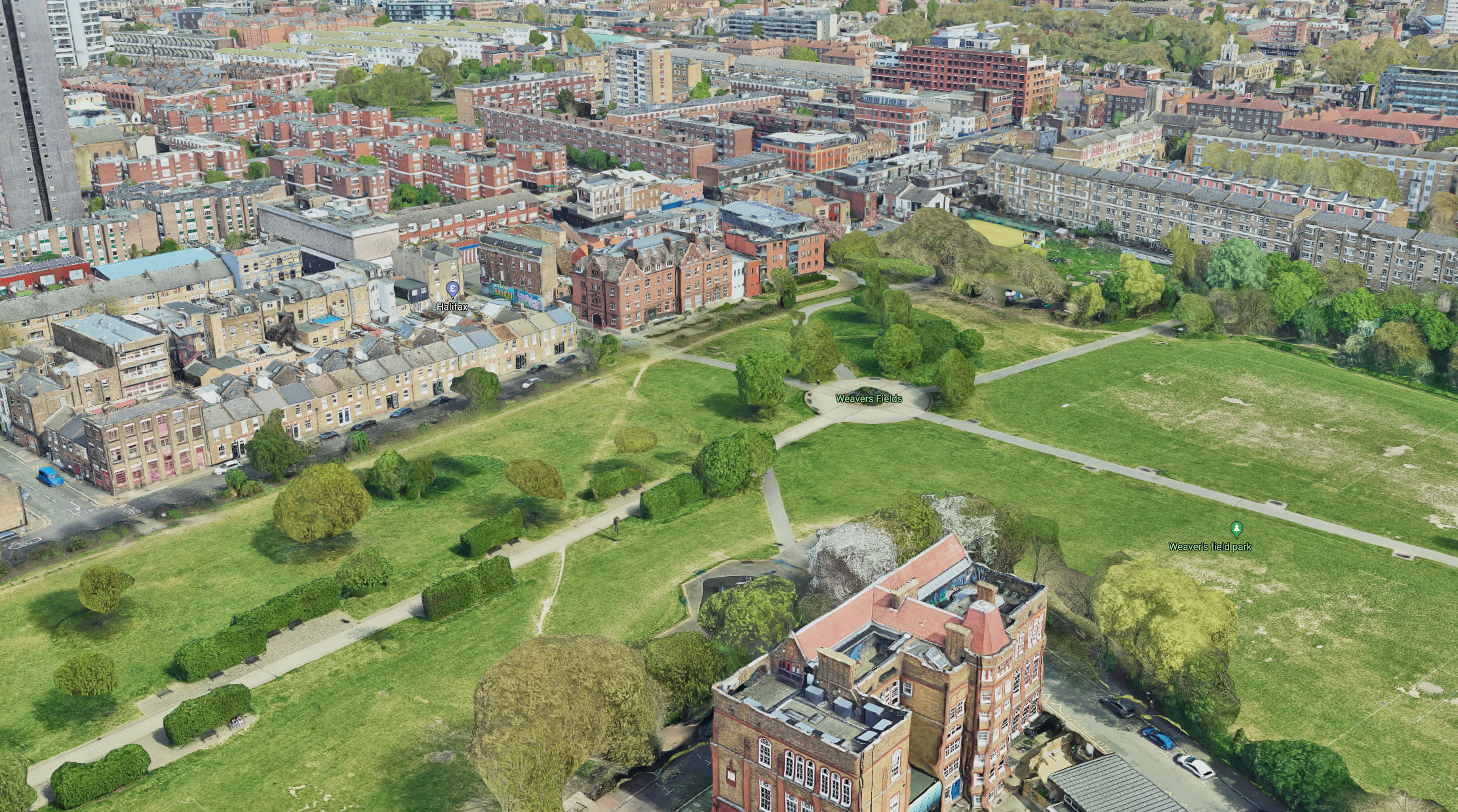
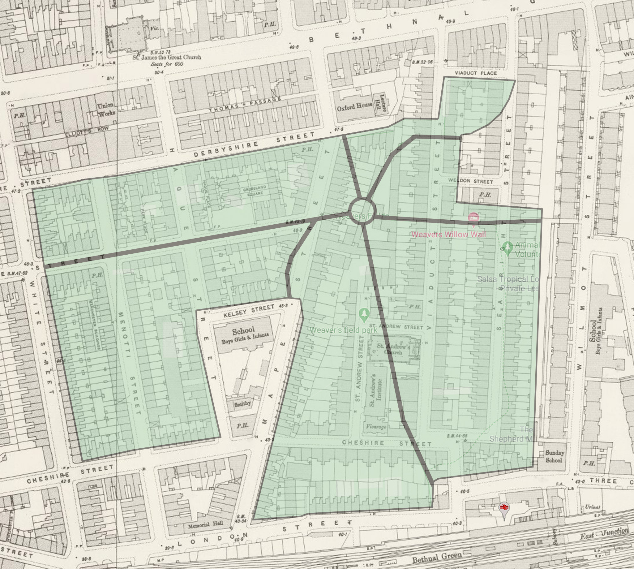
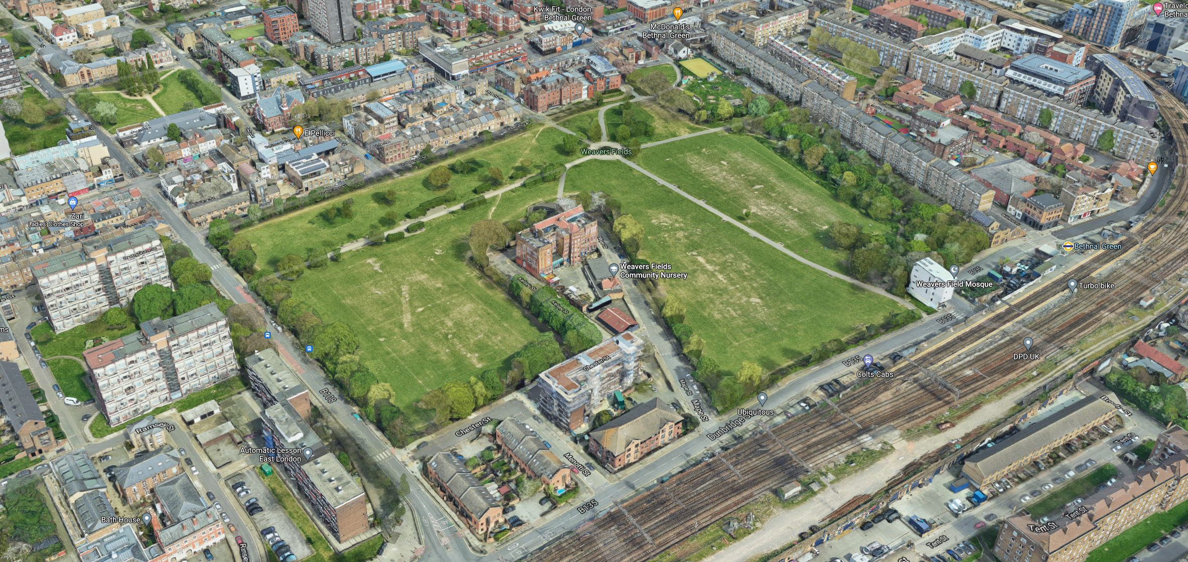
Unfortunately I couldn’t find much on the actual construction or design of the park. But most estimates date the inception of the park as 1967. The layout of the paths roughly mirrors the streets beneath the grass, with the main thoroughfare tracing the route of Sale Street.

You can see the park in these great photographs from Essex Cockney and taken at a fun day in 1970 – https://www.essexcockney.com/weavers-fields
I also found these images from the 1980s in the Tower Hamlets Archive.
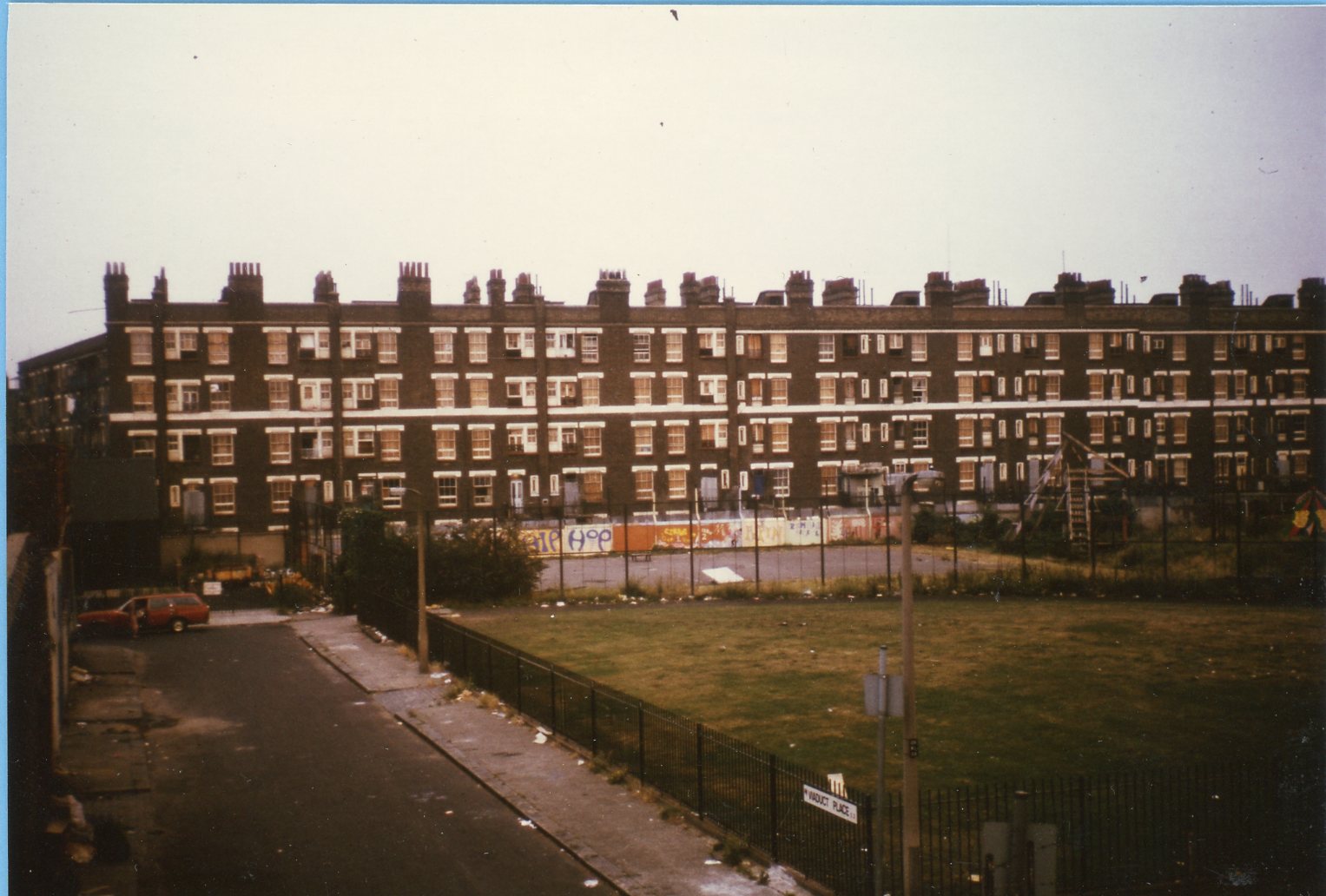
(reproduced with the permission of The Tower Hamlets Local History Library and Archives).
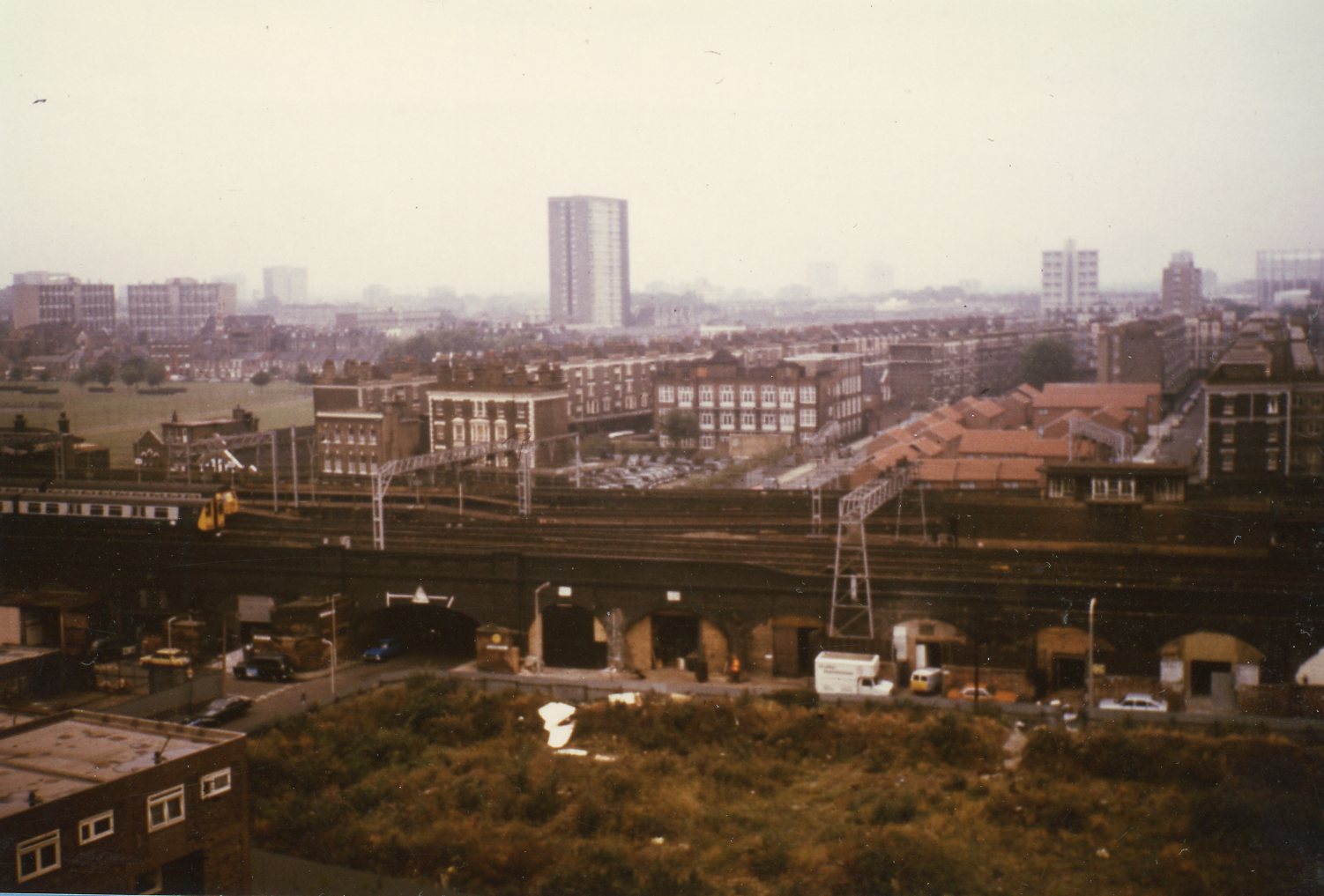
(reproduced with the permission of The Tower Hamlets Local History Library and Archives).
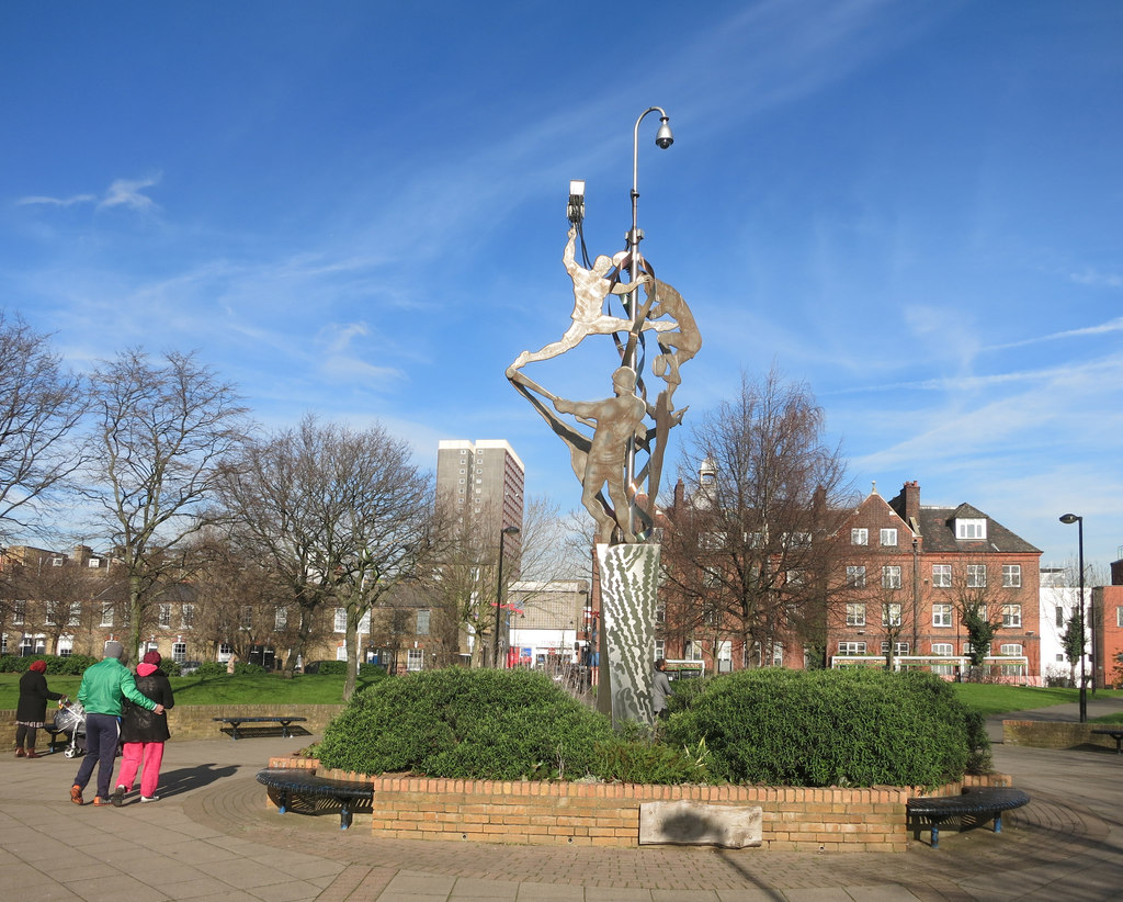
In 2003 a sculpture was installed in the ’roundabout’ area. The sculpture – “Weaving Identities” by Peter Dunn depicts various sports people (and serves as a handy support for CCTV cameras).
Peter’s website has a detailed description of the work and lots of great photographs of the process behind it.
How interesting! I lived at No 5 Wilmot St from 1987 for 12 years. When I moved in interest rates were 13%! If I ever got a taxi home from the West End and said Bethnal Green they always guessed Wilmot St which at the time was very smart following Barratts refurbishment. It was a good community to live in as a 20 something
Hi Helen, that’s an interesting gap in my wilmot street knowledge ! .. I don’t suppose you have any photographs from that time do you ?. Many thanks
thanks very much for all of this info. Mu 2x G Grandparents lived in Abbey St 20 and 24 before they were married. He was a Talow melter
Fabulous History, thanks. My Great Grandparents and Grandparents lived at 18 Hague Street for many years. I have a picture of my great grandmother standing outside the house in Hague Street. All the kids were baptised at St Andrews. Sad to see nothing remains of what was their whole life. They were Huguenot descendants.
Hi Karen, Thanks for the kind words. With your permission I would love to share the photograph with our readers. If you’re agreeable then please send it onto info@wilmotst.com and I’ll be sure to credit you.
Hi Karen interesting reading about your grandparents living at 18 Hague street.my dad Stanley oliver was youngest of four boys born 1924 parents address is 18 Hague St.maybe more than one family lived there.dont know how long they lived there for.
Hi there Sydney……My name is Fred Lang and I lived at number 284 Wilmot Street during the 1940`s, 1950`s and 1960`s………….Oh so happy days……..I went to Wilmot Street infants school and then on to Hague Street junior school and in 1952 having taken my 11+ attended `Parmiter`s school in Approach Road in Bethnal Green…………….I can probably still recall around 30 or more children who lived either in Wilmot Street, Finnis Street, Corfield Street and Ainsley Street……………..I can still recall so many memories including around 30+ names of others growing up at that time…………….It would be lovely to hear from some of them…………..Hoping to hear back from someone who may still remember those days.
Hi Fred, Thanks so much for your reply .. I really hope this site puts you back in contact with some of those people .. anyone that remembers Fred can reply here and you should be able to get in contact !
thanks once again
Born in 1944, l grew up in Hemming street and went to Hague Street primary. All my family lived locally and my grandfather ran Ringles garage on Vallance road. My uncle bill Blackley had the bike shop on Vallance road. We were moved out in 1959 for “slum clearance” my were my grandparents who lived next door. Your photographs bring back many memories. I had friend who lived on Wilmot street.