There are three parts to this post, the first deals with the history of the area up until 1938, the second the clearing, demolition and eventual development of the park and the third and final part details each street in turn.
- Part one – Growth (1700 – 1938)
- Part two – Demolition (1938 -1968)
- Part three – The lost streets of Weavers Fields
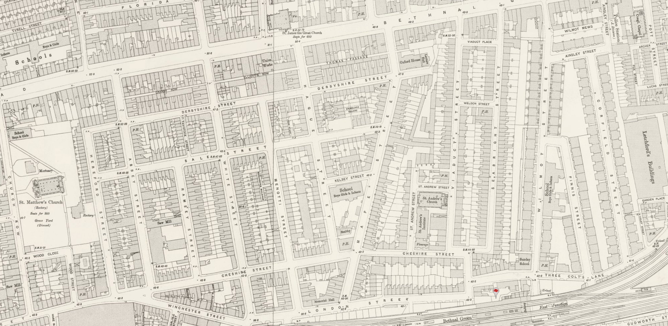
Abbey Street
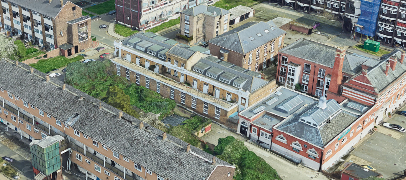
Abbey Street ran from Bethnal Green Road down to Cheshire Street. It was reconfigured and cleared to make way for the Hereford Estate, the north portion of the road replaced in part by Buckfast Street.
Notable buildings include –
Bethnal Green British School – There was a Sunday School at the school, the history of which is detailed in the carefully scanned pages found here.
The building still stands on the now redirected Ramsey Street and have been converted into flats.
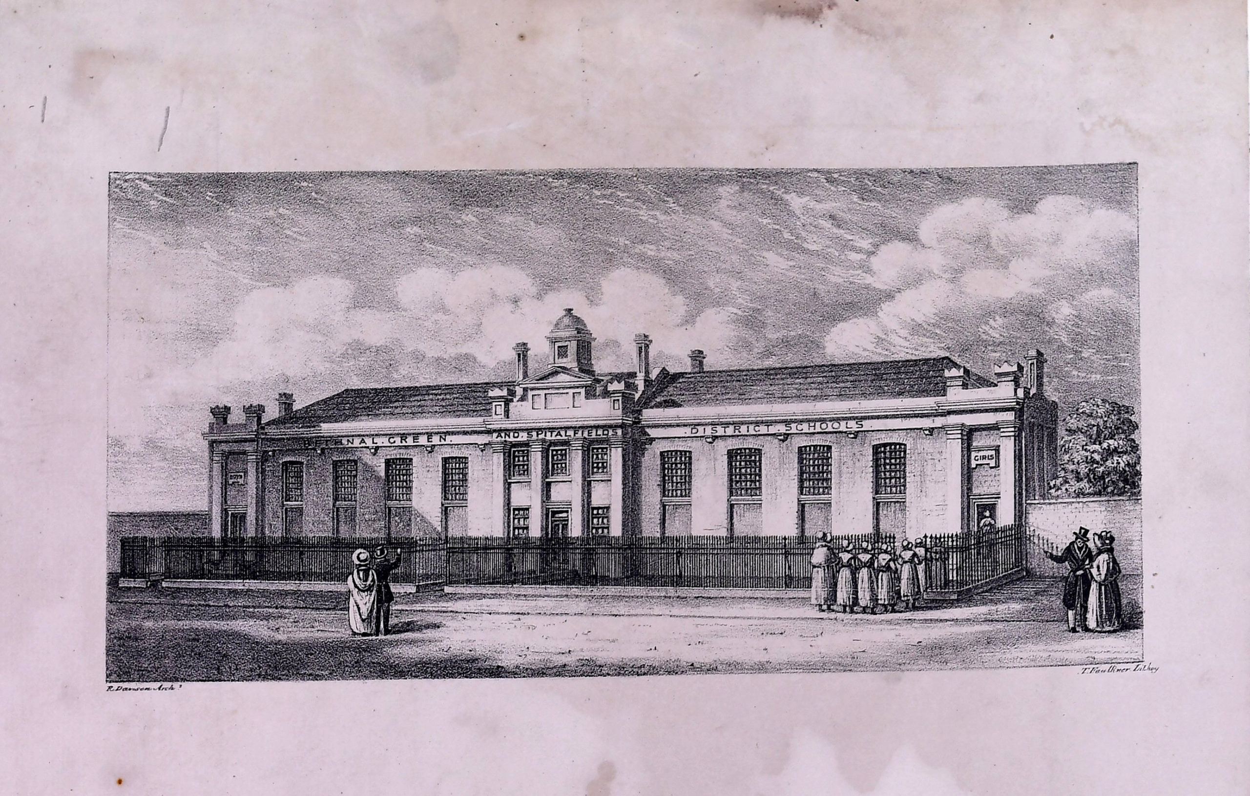
(Brunel University London Archives)
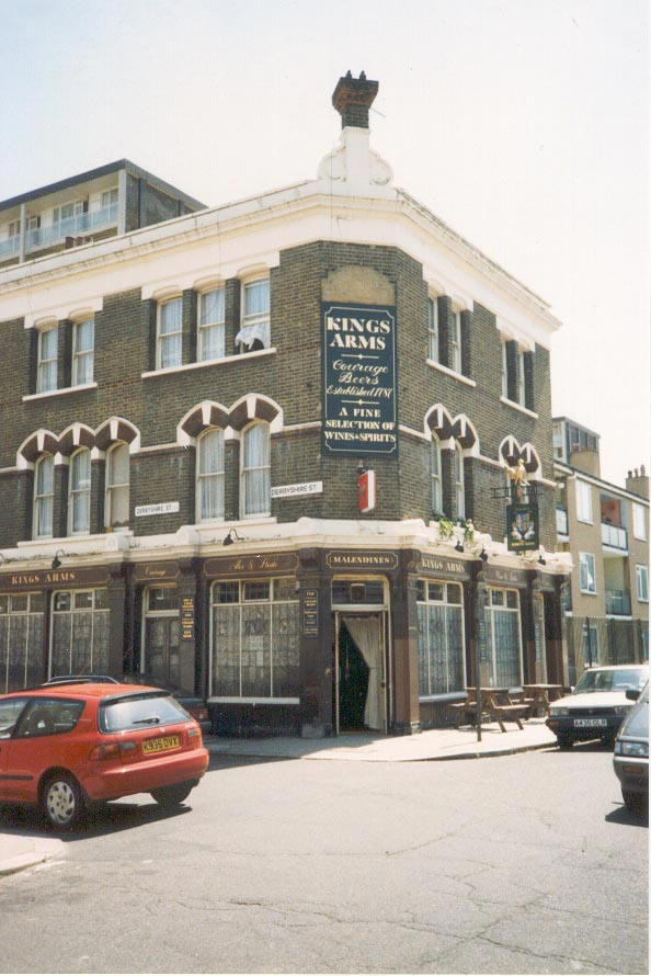
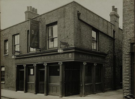
Kings Arms Pub – Still open today, According to Pubwiki it existed from at least 1829.
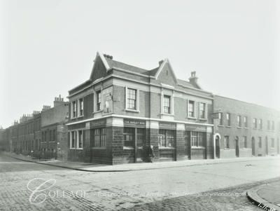
Cheshire Street
Cheshire Street has had many guises. What we now know as Cheshire Street was once Hare Street, running from Brick Lane and splitting into Cheshire and Winchester Street where they met Abbey Street.
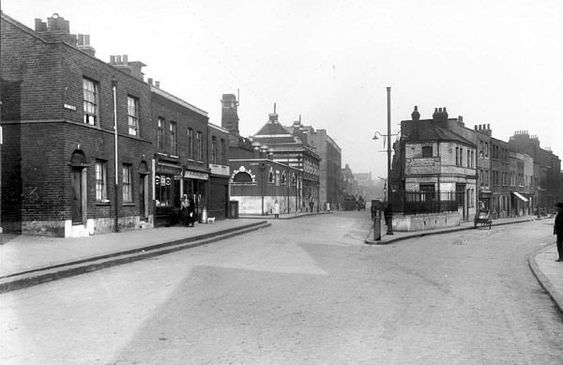
You can see the Bath House in the centre of the picture, still standing today and converted into flats. .
This junction was also the site of a workhouse (further details here).
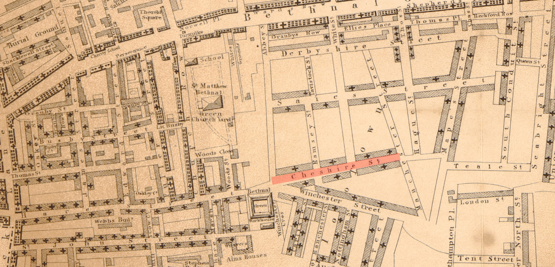
At some point Hare Street became Cheshire Street, and what was Cheshire Street became Chester Street.
Notable buildings include-
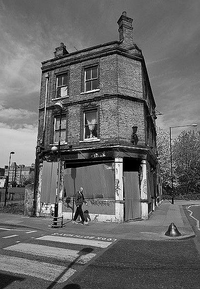
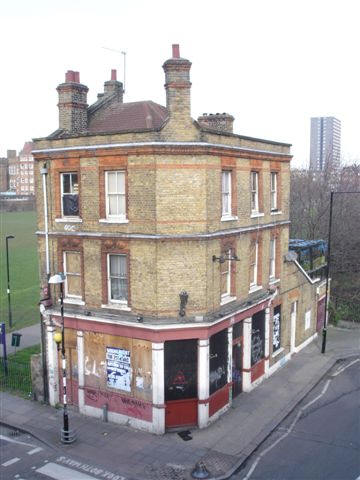
Silver Trumpet Pub – 145 Cheshire Street, Until the 1870s this pub was called the Fortune of War – pubwiki

From Pubwiki (kindly provided by John Carnaby)
More details on Cheshire Street can be found A London Inheritance site.
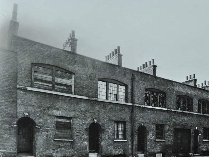
Derbyshire Street
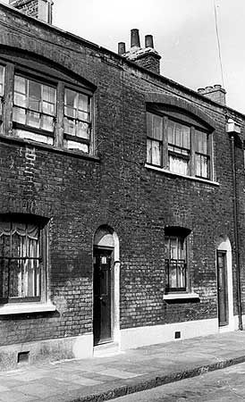
Derbyshire Street still exists today and is our best insight into how the streets would have looked before the clearance.
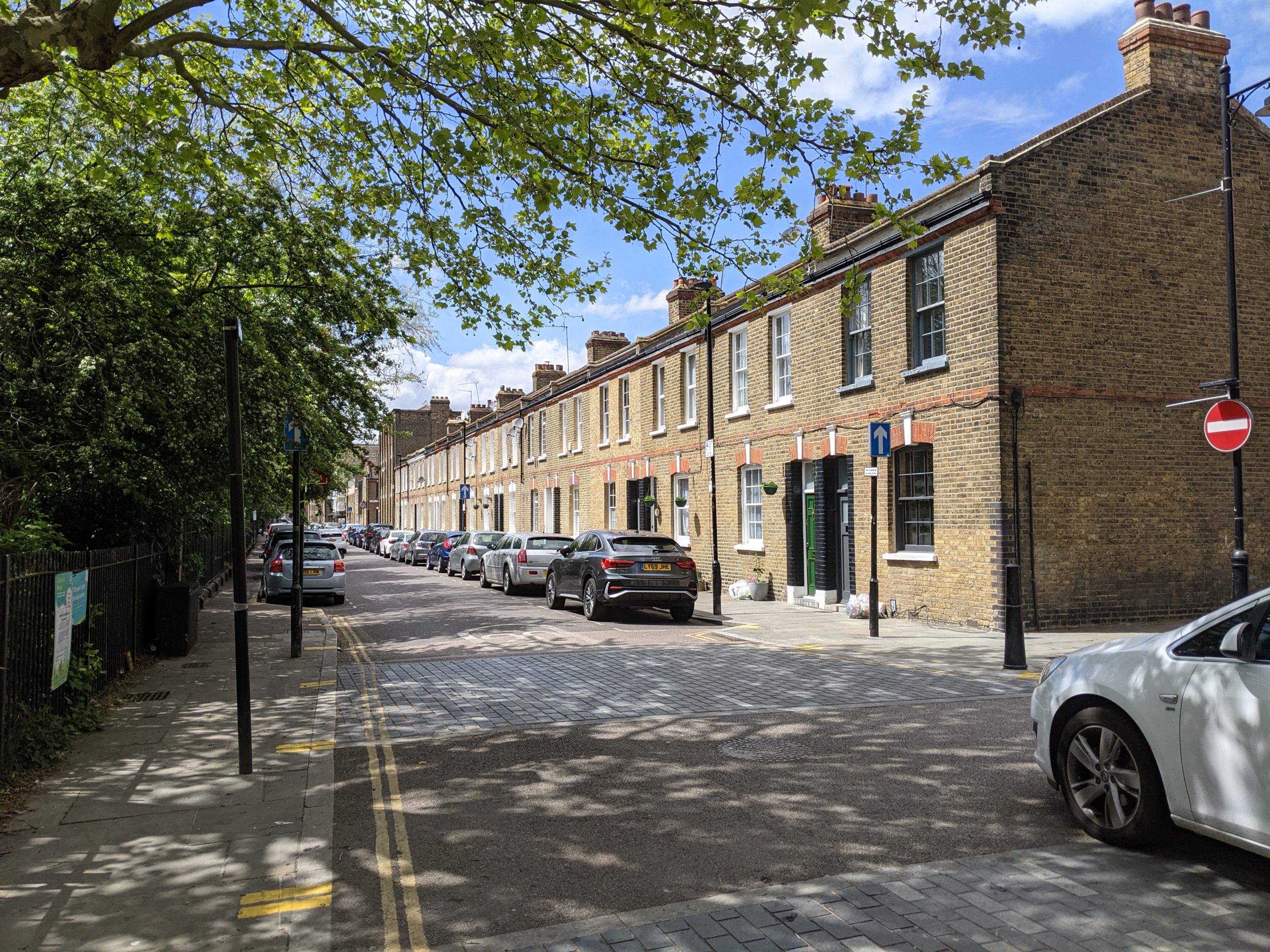
Notable buildings include –
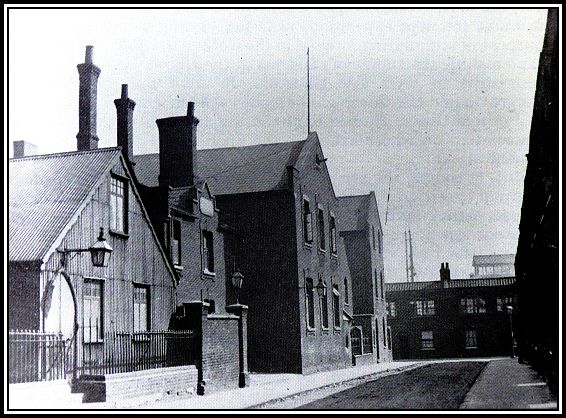
Oxford House – Oxford House is a “Settlement House“, established by Oxford University to encourage privileged graduates to undertake social work in very poor areas.
‘that Oxford men may take part in the social and religious work of the Church in East London; that they may learn something of the life of the poor; may try to better the condition of the working classes as regards health and recreation, mental culture and spiritual teaching; and may offer an example, so far as in them lies, of a simple and religious life’. Walter Besant described the settlements as ‘lamps in a dark place’.
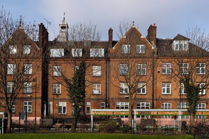
Oxford House was founded in 1884 and the brick building which stands today was built in 1892 and is now Grade II listed.
Website of the current Oxford House – https://www.oxfordhouse.org.uk/
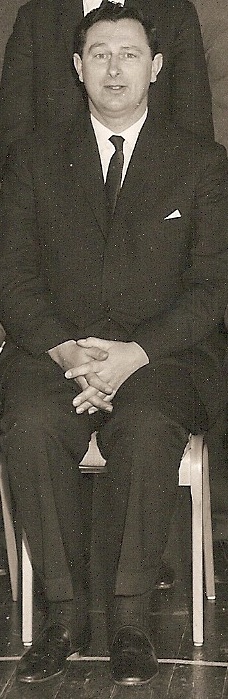
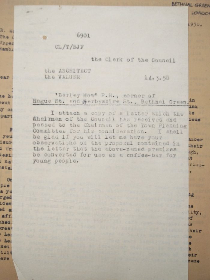
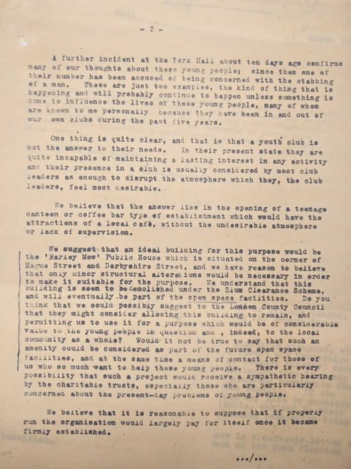
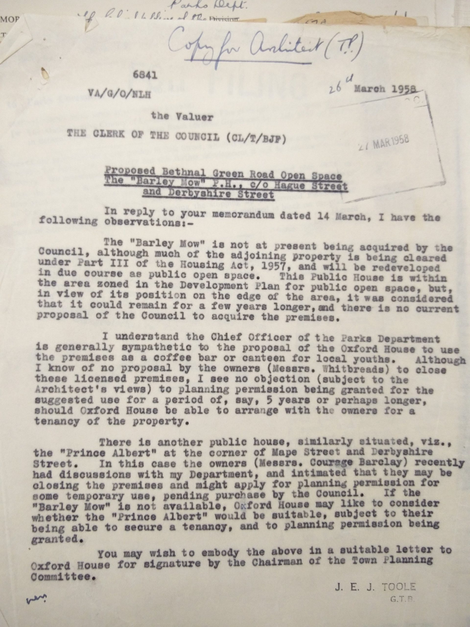
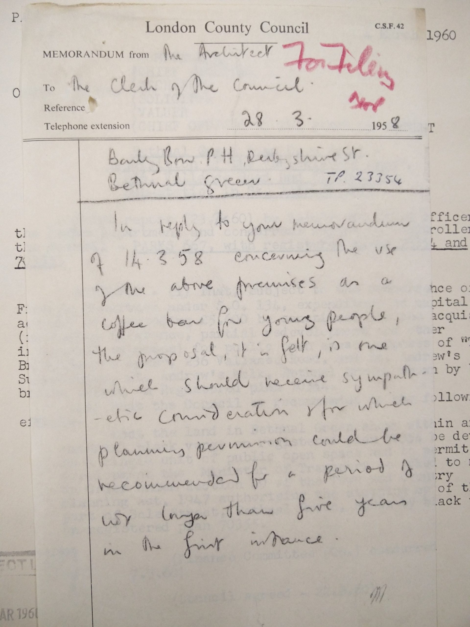
I came across this interesting exchange between Peter Duke the head of Oxford House and the County Council in 1958, regarding turning over the now empty Barley Mow pub on Hague Street to create a coffee bar for the local unruly youths.
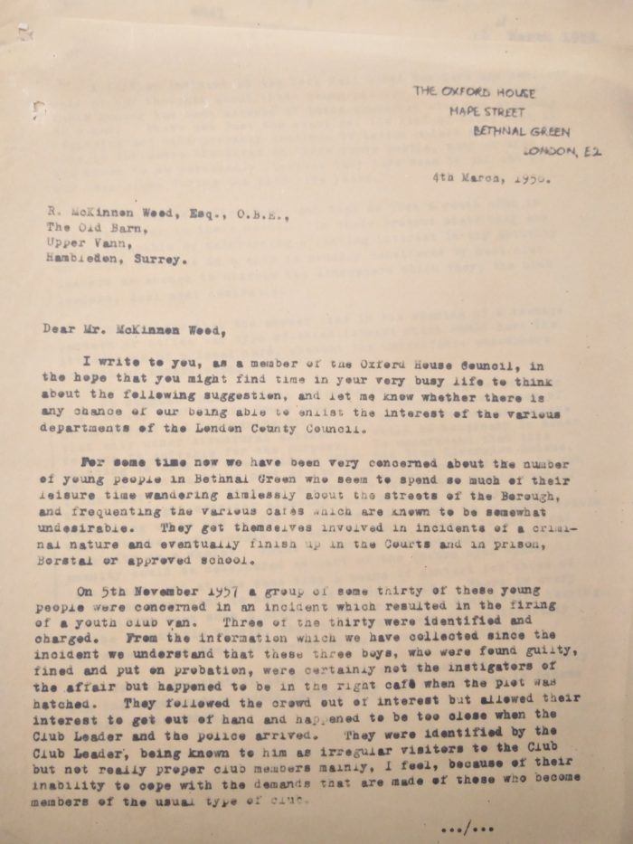

I also came across this comment on Spitalfields Life by Linda Wilkinson, regarding Peter Duke’s feelings about the clearance of the streets –
“How strange, I am involved in a project with Oxford House and last week interviewed one of their former Heads, Peter Duke. He was most exercised these many years later about the slum clearance of the 1950’s and 60’s which decimated communities. He said that every Saturday was like a funeral as people packed up their old homes and left.”
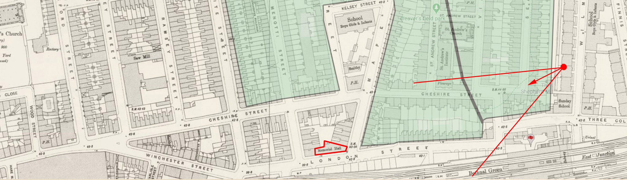
Hague Street
A tiny portion of Hague Street still remains. It leant its name to The Hague Street School, which moved to Wilmot Street in the 1965 and was renamed The Hague School. The listed building that was once the school sits marooned in the middle of Weavers Fields and is the home to the Weavers Fields community nursery. Between 1965 and 1989 this was also a school for “maladjusted children aged 5–16”.

Barley Mow pub – which Oxford House wanted to acquire and turn into a Teenage Coffee Shop.

London Street (now Dunbridge)
London Street has now become Dunbridge Street.
Notable buildings include-
List of Business names on London Street from 1921 business directory
Memorial Hall – I’ve not been able to discover much about the Memorial Hall other than a few mentions.
Christian Community.
https://www.british-history.ac.uk/vch/middx/vol11/pp228-240
After severing its Meth. connexion c. 1819, community held open-air svces. in Bonner’s Fields and, often with other groups, met in Cheapside (Lond.) and Shoreditch. Used mission room in Menotti St. 1872 and opened Christian Community Memorial hall, commemorating centenary of reorganization, 1875. Acquired site at junction of London (later Dunbridge) St. with Mapes St., bought by Ind. min. Wm. Tyler of Hanbury St. (Spitalfields) ch., 1878. Bldg. in Gothic style, seating 700, used for religious mtgs., Sun. sch., men’s club, and lectures and closely associated with Lond. City Mission. Extended by free libr., inc. books given by royalty, 1881. Attendance 1903: 3 a.m., 79 p.m. Libr. closed 1934 and memorial hall 1949. Headquarters of Community moved to Good Shepherd mission, Three Colts Lane, and after 1973 to Romford (Essex).

The Hall also housed a library –
A library in the church was to be locked by the vestry clerk in 1812, after books had been taken out of it ‘improperly’, and was included in repairs in 1820. After a failure to secure the adoption of the Public Libraries Act in 1875, Bethnal Green Free library was founded by the Christian Community in 1876. Initially in cramped rooms in London Street, it relied entirely on voluntary support, which included a gift from the Prince of Wales. In 1881 the library moved to the community’s memorial hall in London Street and by 1882 it had been given c. 7,000 volumes. The library, an unsuccessful contender for a site on the Poor’s Lands in 1888, survived until 1934.
Lord Hood (Old Cavalier) Pub – closed pubs entry

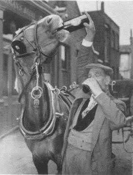
Kindly provided by Alex Wilkinson
For the record, Mr F R Rogers is a regular customer, whose horse can down a pint in ten seconds, and is a constant drinking companion of Mr Rogers!”
Mape Street
A portion of Mape Street still exists. The East End Women’s Museum has a fascinating insight into life on Mape Street from Alice Pike who was the daughter of a weaver and lived on Mape Street.
Prince Albert Pub (corner of Mape and Derbyshire) – pubwiki
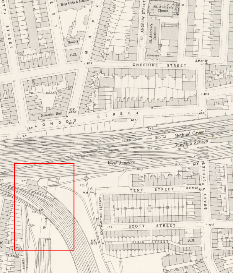
Mape Street Tunnel – A mysterious section of train track seems to turn and head up to follow the direction of Mape Street. Rail enthusiasts have debated whether it was intended to continue all the way up to Cambridge Heath Road.
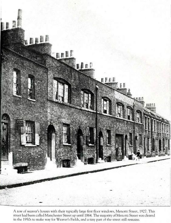
Menotti Street


Ramsey Street
A portion of Ramsey Street still exists, and is redirected around to meet Hereford Street.

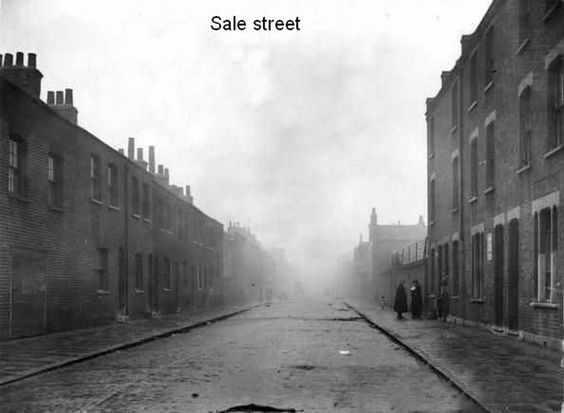
Sale Street
A very small section of Sale Street still exists today, but it is almost completely cleared. However you can still trace its route as it once sat under what is now the main East to West path through Weavers’ Fields.
You can read lots of detail about Life on Sale Street on the Mallandain Family history site.

Seabright Street
Named after Sebright family

Notable buildings include –
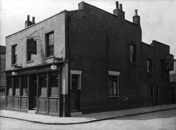
Duke of Gloucester Pub – pub wiki entry
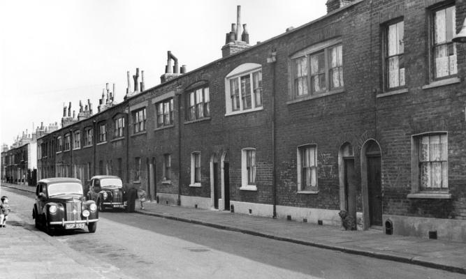
Vallance Road (was White Street)

Vallance Road still exists today and borders the park to the west. Nothing exists of the original homes which lined the street.
Notable buildings –
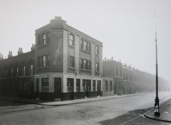
The Bricklayers Arms pub – pub wiki entry.

Viaduct Street
Notable buildings include-
Wolverley Arms Pub – 62 Viaduct Street – pub wiki entry.
Wolverley Arms, 62 Viaduct Street
(https://pubwiki.co.uk/LondonPubs/BethnalGreen/WolverleyArms.shtml)
Saint Andrews Church – Viaduct Street [1841/43] Closed & demol.1958, parish united with St. Matthew.
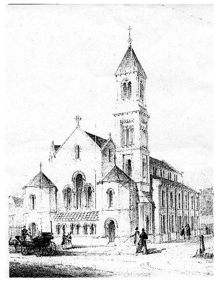
Records of births deaths and marriages are held at the National Archives.

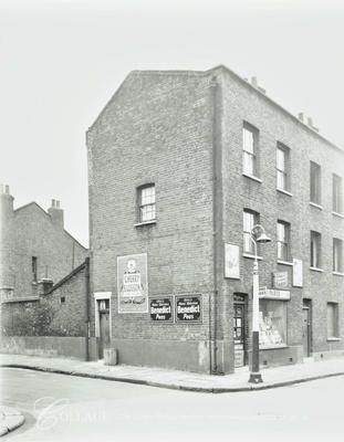
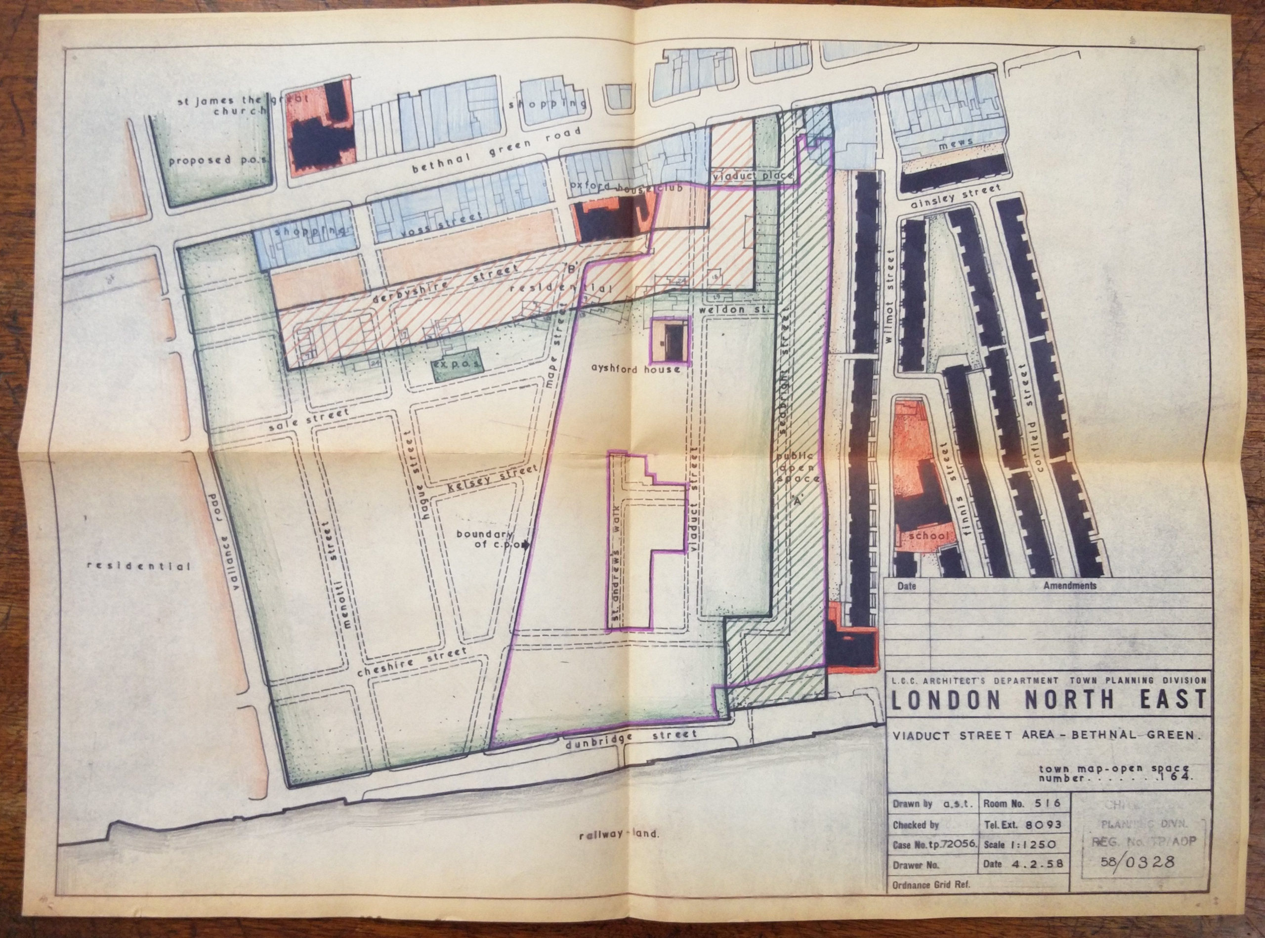
Ayshford House – The building has long been a mystery to me. It escaped demolition until 2004 and sat marooned in the park. Internal council correspondence from 1954 states –
“Ayshford House, the property in Viaduct Street shown uncoloured on the plan, is a modern 3-story residential block and it is not proposed that this should be acquired.”
(reproduced with the permission of The Tower Hamlets Local History Library and Archives).
A have some comments from readers stating –
“Wilmot Street all I can remember is that Ayshford house was in a road called Viaduct street. There was a dairy on the corner and a marble works half way down. My mum lived in a house opposite Ayshford house when she first got married but it was bombed in the war. My grandad had a shop in Bethnal Green road that was opposite Viaduct street it’s still there but it is a charity shop now it’s next to quick fit. It was a coach station”
“There was only 6 flats in Ayshford house they were quite big”
I’ve managed to track down the planning documents detailing its uses and an idea to convert the building into flats and an ecology centre. Unfortunately this didn’t happen and the building was demolished. The planning documents state –
2 Ayshford House was at some point acquired by the GLC and used to house park employees until transferred to LBTH on the demise of the GLC. Although remaining the property of the Parks Department it was allocated to the housing department for general needs housing until 1994, when structural investigations led to a view that the building was beyond economic repair and new lettings seem to have ceased. There was a proposal to use the flats for homeless families but by 1998 the block was occupied by one sitting tenant and several squatters and both the 1996 planning permission involving its demolitionand the proposed occupation by the Homeless Families Unit had been abandoned. The tenant has been or is being re-housed.
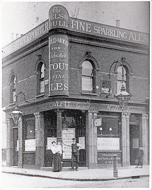
Winchester Street (now Dunbridge St)
Winchester Street has now become Dunbridge Street.
Notable buildings include-
The Welsh Bull Pub – pub wiki entry
- Return to Part one – Growth (1700 – 1938)
- Return to Part two – Demolition (1938 -1968)
What a fantastic piece of research. Thank you
I’m looking for any old photos of 17 Chester Street where an ancestor ran a business up until 1916?
Really appreciate all your interesting data on the area.
Id love to get any information or see pictures of 303 Corfield Street, Bethnal Green.
Family address. I spent my first 6 months of life in Bethnal Green.
Crazy! I grew up on Turin street nearby and to see this piece of history about Bethnal Green fills with a nostalgia for a time gone by. Makes you wonder how children in 100 years will view today!
Did Thomas Street (mentioned in the earliest part of the history) become part of Hague Street? The maps look like it priobably did, and indeed that the remaining part of Hague Street is the Thomas Street part
Hi Roy, yes it looks like it was previously Thomas Street