Documenting the history of the Waterlow Estate in Bethnal Green, East London. Comprising Wilmot, Corfield, Ainsley and Finnis Street the Waterlow Estate was built by the Improved Industrial Dwellings Company starting in 1869.

Month: December 2016

Wilmot Street in 1938

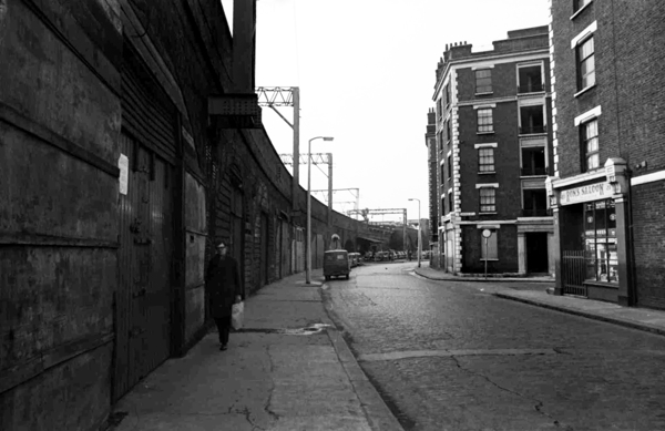
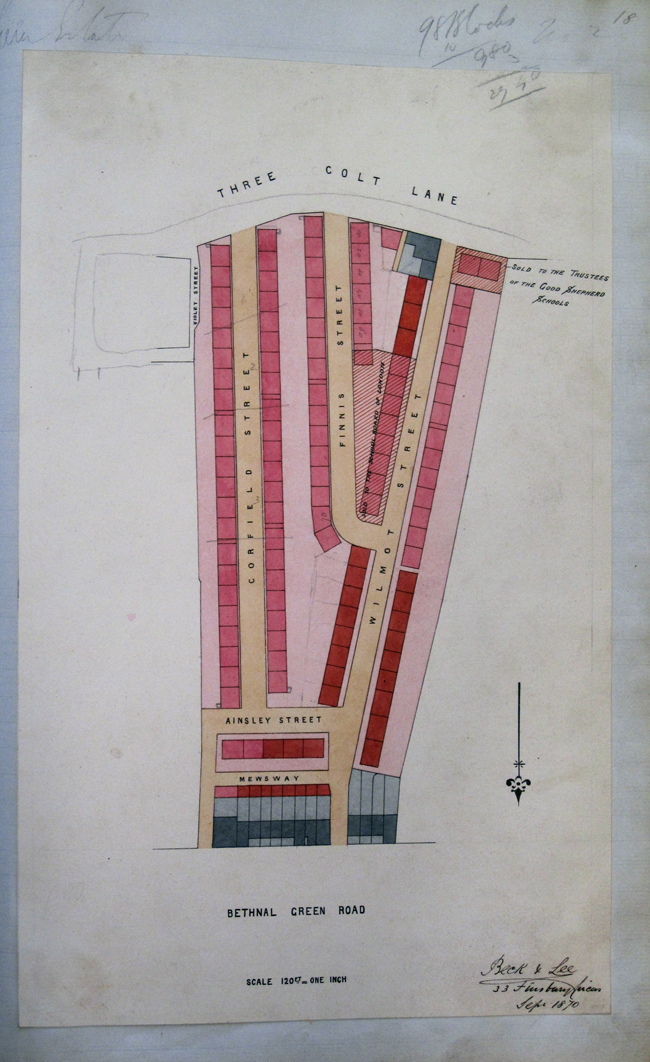
I recently found this photograph of A.R.P. (Air Raid Protection) parading along Wilmot Street in 1938. There’s an interesting brick structure on the west side of the road, it seems to be about 6 feet tall. I’ve no idea what it is and it’s no longer present on the street. If anyone can shed any light on this I’d appreciate the help !

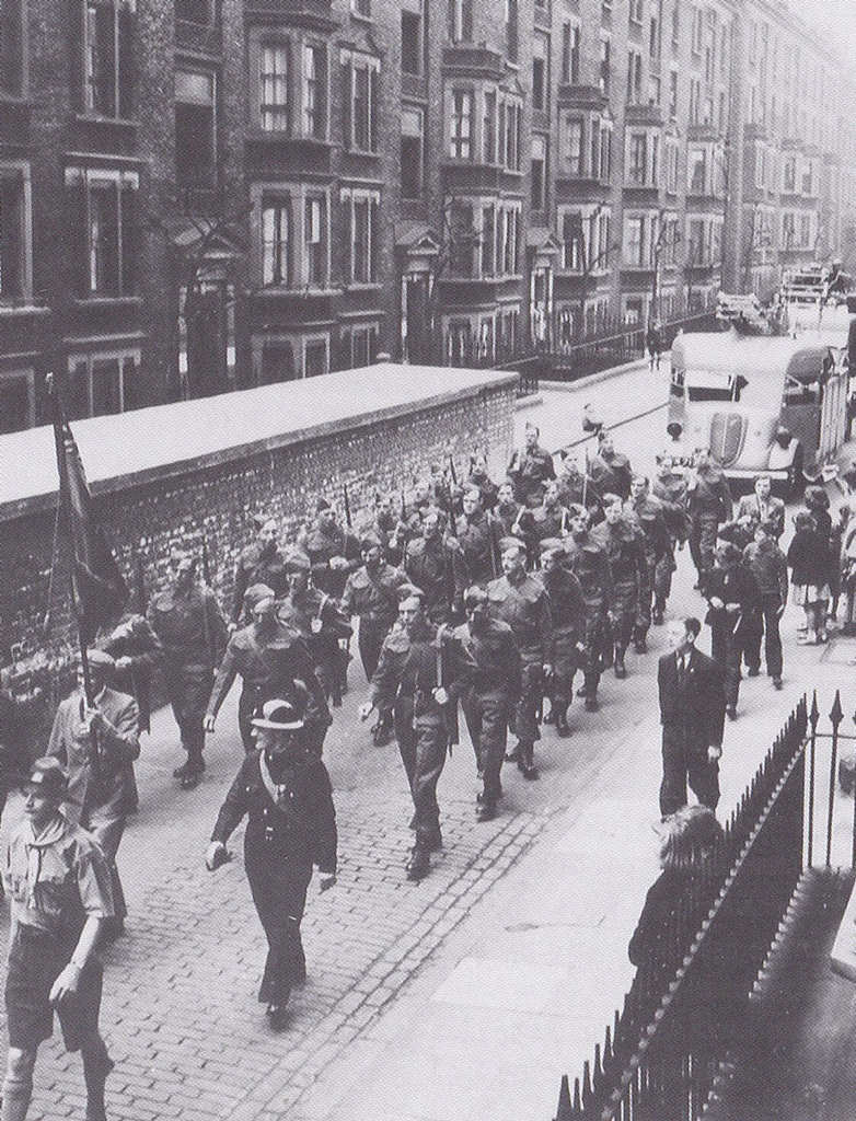
UPDATE: I’ve had some suggestions that this was might have been a communal air raid shelter. Interestingly it seems that a high explosive bomb fell very near this spot on Wilmot Street at some time between October 1940 and June 1941 (link). This bomb could be related to this event referenced by the ARP WW2 Twitter project:


There is also mention of an air raid shelter near Wilmot Street in this book about the Kray Twins (Reggie Kray’s East End Stories: The lost memoirs of the gangland legend).

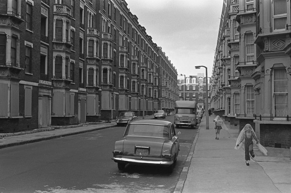
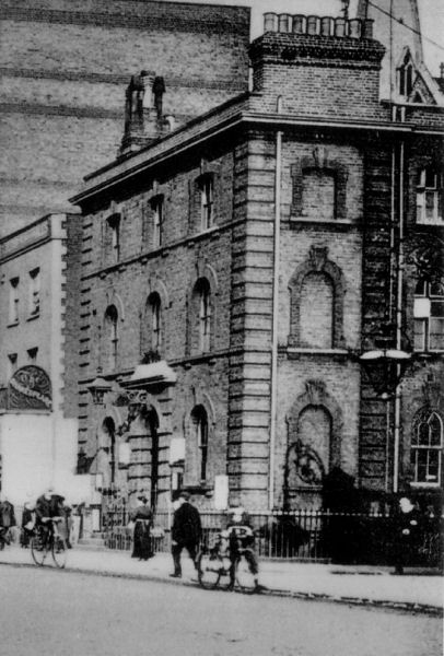
The structure does look similar to this communal shelter:

If you can help solve this mystery then please leave a comment !

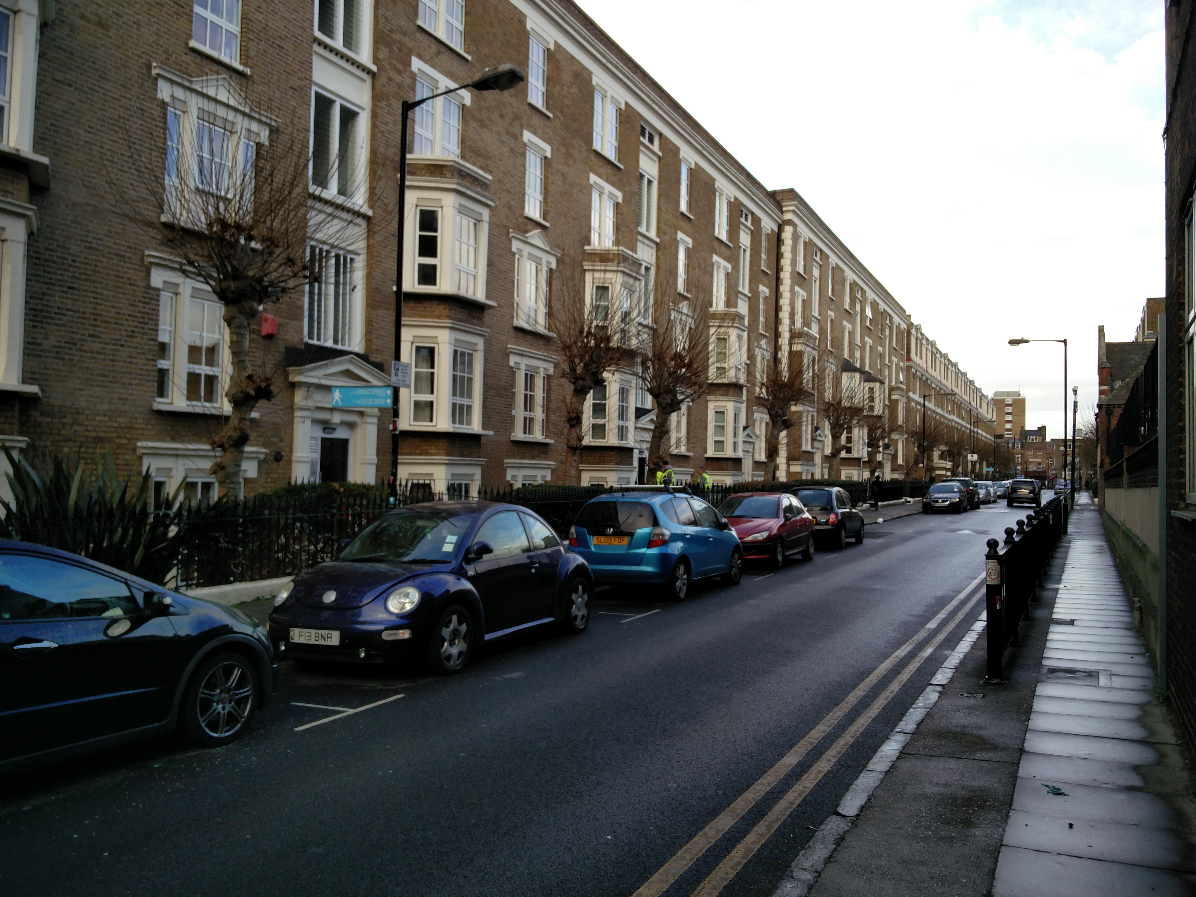
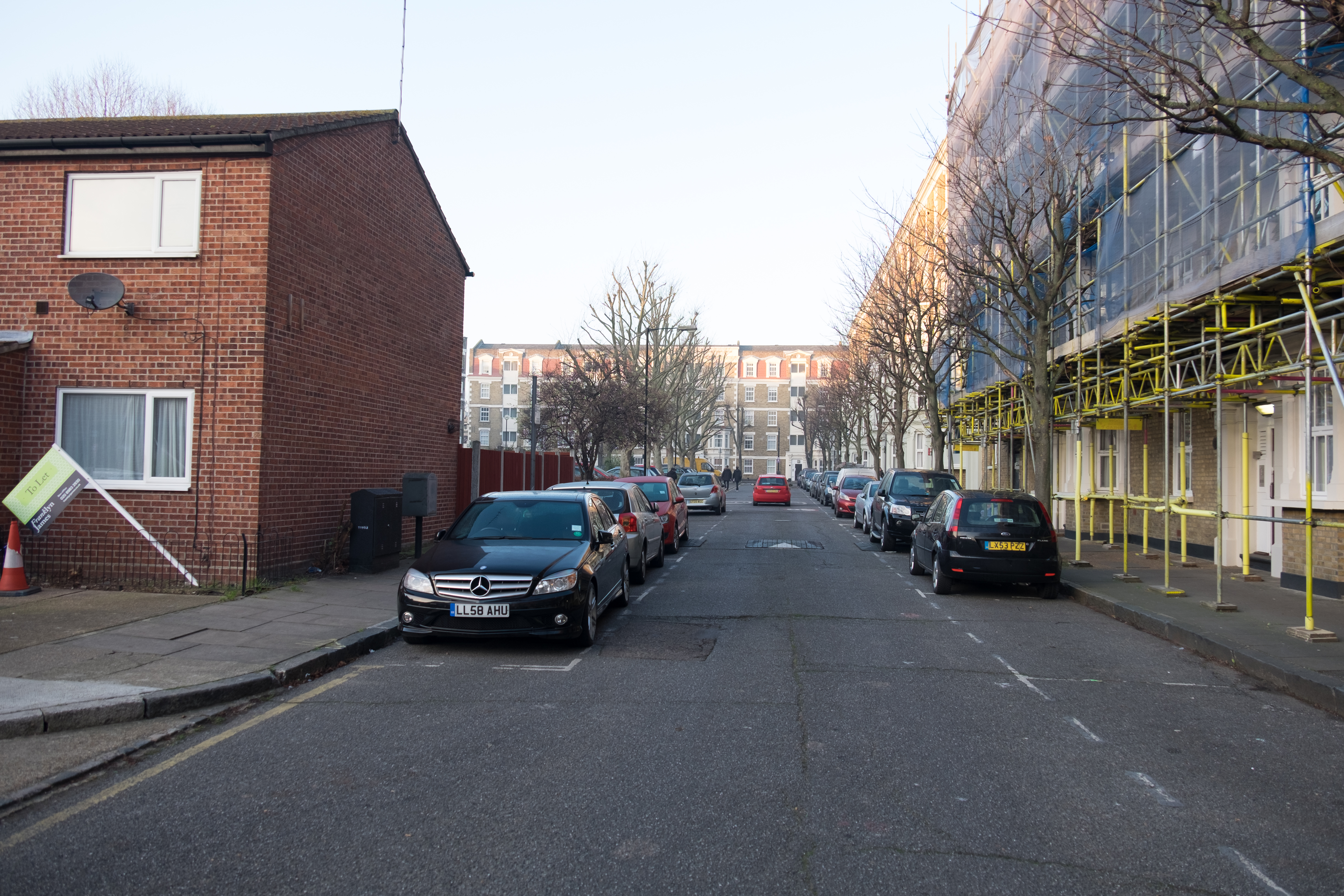
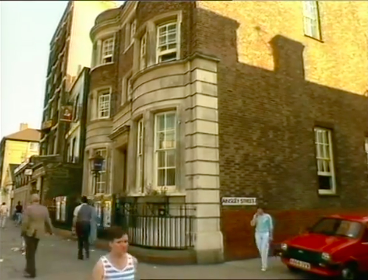
Here’s a photograph from today from roughly the same area (although a little further north).


Photographs of Corfield and Finnis Street

In a recent post (Memories of growing up on Corfield Street) I mentioned that I have come across a number of photographs of Corfield Street before the blocks on Western side of the Street were demolished. As promised here are the photographs (with sources where available).

Corfield Street 1968.

Source: London and Middlesex Archaeological Society Journal Vol22 part1 (http://www.lamas.org.uk/transactions-archive/Vol%2022.pdf)

Corfield Street, looking North from Three Colts Lane. c1970

Source: unknown

The rest are a series of photographs by Andrew Scott which were posted on the Spitalfields Life website.

Looking north up Corfield Street. The blocks on the left are boarded up ready for demolition.

Inside one of the Corfield Street flats.

Below I’ve posted a couple of images showing Corfield Street today, both are taken looking South to North.

Returning now to Andrew Scott’s photographs, but this time showing Finnis Street.

This is a guess but I think this photograph is taken from the rear of the now demolished Western side blocks on Corfield Street looking North West toward the rear of Finnis Street buildings with the Wilmot Street blocks in the far distance.

This is looking North towards Ainsley Street somewhere between Finnis and Corfield Street. By the looks of things this is during the demolition of the Corfield and Finnis Street blocks seen in the earlier photograph. You can also see a portion of what is now the Hague School on the left (this school used to be known as Wilmot Street Primary, and the Hague school was situated in the building which still stands on Mape Street). The blocks on the right are the rear of the now demolished western Corfield blocks.

This is a similar angle looking up through Finnis Street today.

Finally an image of Three Colts Lane with Ron’s Saloon to the right (also mentioned here). This photograph is by Tony Hall and is featured on Spitalfields Life.

If you look at the plans below (from the Metropolitan Archive) you can get an idea of where these photographs could have been taken.


Bethnal Green Police Station

On the corner of Ainsley Street and Bethnal Green Rd sits an interesting building. Numbered 458 Bethnal Green Road, it is now the home of Providence Row Housing Association who work in the local area helping people at risk of homelessness. However it was once Bethnal Green Police Station.

Bethnal Green Police Station c1984

I’m unsure when the Police Station closed but I’ve managed to find two pieces of video footage showing the Station when it was up and running. The first seems to be some exterior library shots for Thames TV News from the 1980s.

The second is more extensive and is a collection of footage and photographs from someone who worked in CID. The video is captioned as being shot in 1991.

Historically the station was home to the J Division from around 1868 until 1933 when it fell under the H or Whitechapel division. There’s a fairly detailed breakdown of the history of the station on Bryn Elliot’s Police history site.

Bethnal Green Police Station c1907

There is also a mention in the London Echo of extra police patrols during the era of Jack the Ripper:

During the month of August, and up to the 8th instant, when Annie Chapman was killed, the following beats were covered by the men of the J Division quartered at Bethnal green, these forming what is known as the “Second Section night duty.” The first police constable would commence his two beats at Wilmot street, three Colt land, Cheshire street, Mape street, Bethnal green road, to Wilmot street, and the interior, this consisting of a few streets, courts, passages, &c. The second constable would cover Three Colt lane, Collingwood street, Darling row, Dog row, Whitechapel road, Brady street, to Three Colt lane, and the interior, this consisting of about twenty streets, courts, passages

You can read the full article here.

Unfortunately I’ve been unable to find much more about the Police Station. I’d love to hear from anyone that knows about it’s history. Please get in touch via the comments.

further links: