Documenting the history of the Waterlow Estate in Bethnal Green, East London. Comprising Wilmot, Corfield, Ainsley and Finnis Street the Waterlow Estate was built by the Improved Industrial Dwellings Company starting in 1869.
There are three parts to this post, the first deals with the history of the area up until 1938, the second the clearing, demolition and eventual development of the park and the third and final part details each street in turn.
There are three parts to this post, the first deals with the history of the area up until 1938, the second the clearing, demolition and eventual development of the park and the third and final part details each street in turn.
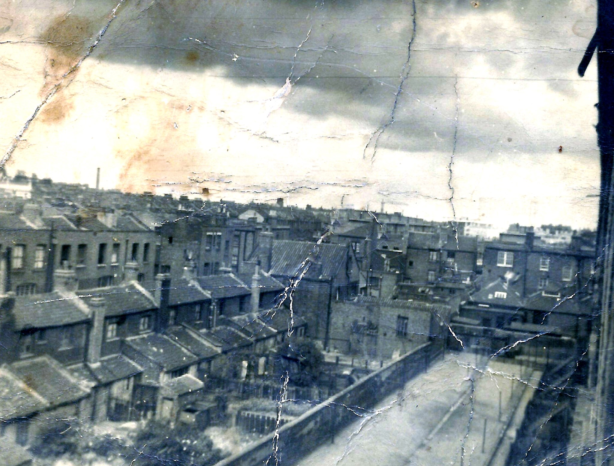
“This was taken from my grandparents window in Wilmot street, this overlooks Weavers field, looking towards Bethnal Green road, unsure of the year, but I would imagine pre war.” – Photograph kindly supplied by John McCarthy
“The whole of western Bethnal Green was scheduled for redevelopment under a 5-year plan for 1962-7, the southern part for industry, relieved by an open space called Weavers’ Fields around Mapes Street”
The Tower Hamlets archive holds a number of files filled with correspondence and drawings detailing the clearing and development of Weavers Fields. Much the information here is drawn from those files.
These are fascinating documents, filled with personal notes, annotations and asides. To recapture this era of local authority bureaucracy and drawing offices I’ve reproduced some of the actual documents. You can almost smell the tobacco filled council offices.
Since I started researching the Waterlow Estate I’ve unearthed lots of historical details and photographs of neighbouring Weavers Fields Park and the streets that are now buried beneath the grass.
There are three parts to this post, the first deals with the history of the area up until 1938, the second the clearing, demolition and eventual development of the park and the third and final part details each street in turn.
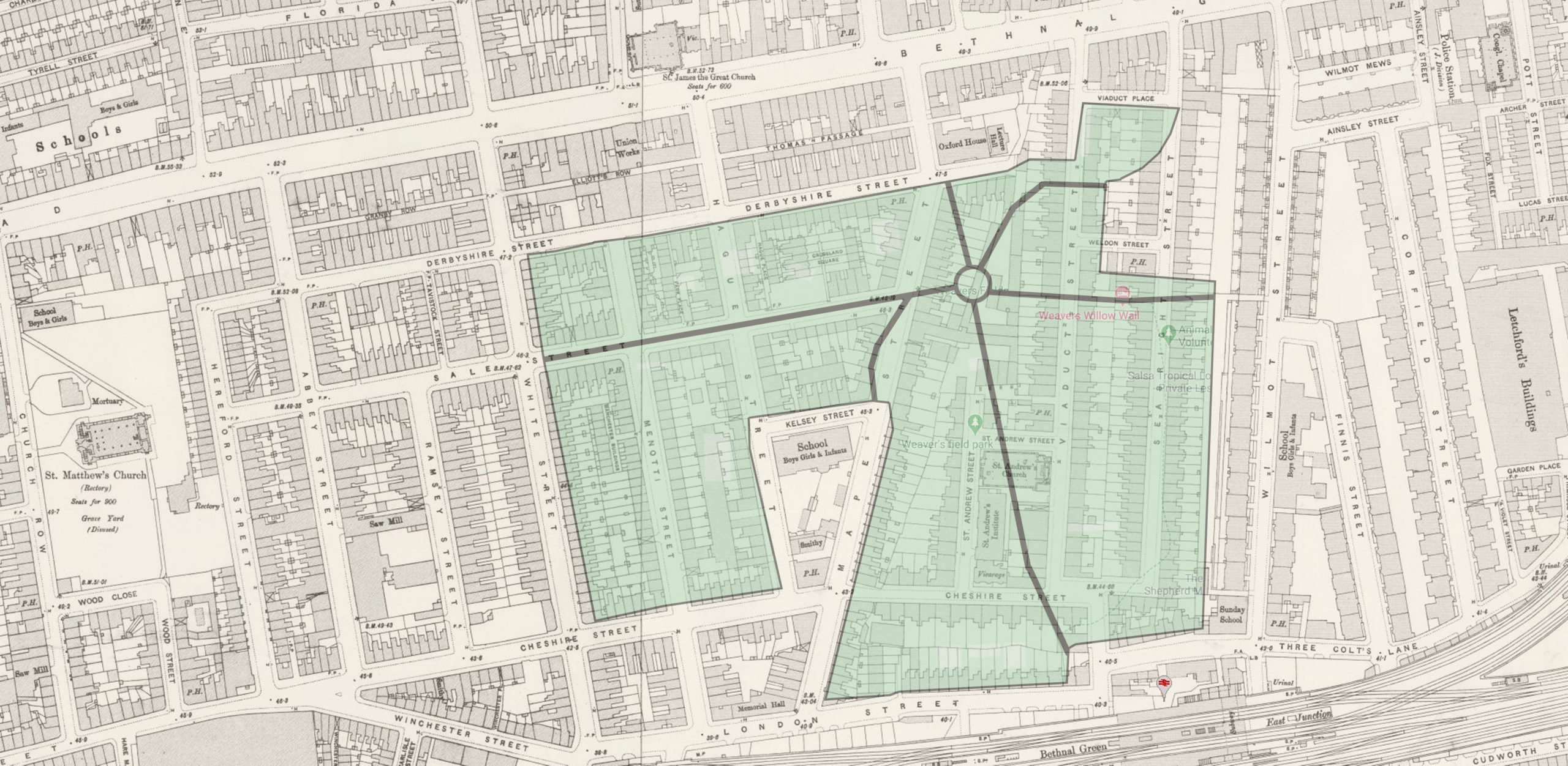
Looking south west over Weavers’ Fields – a comparison between then and now
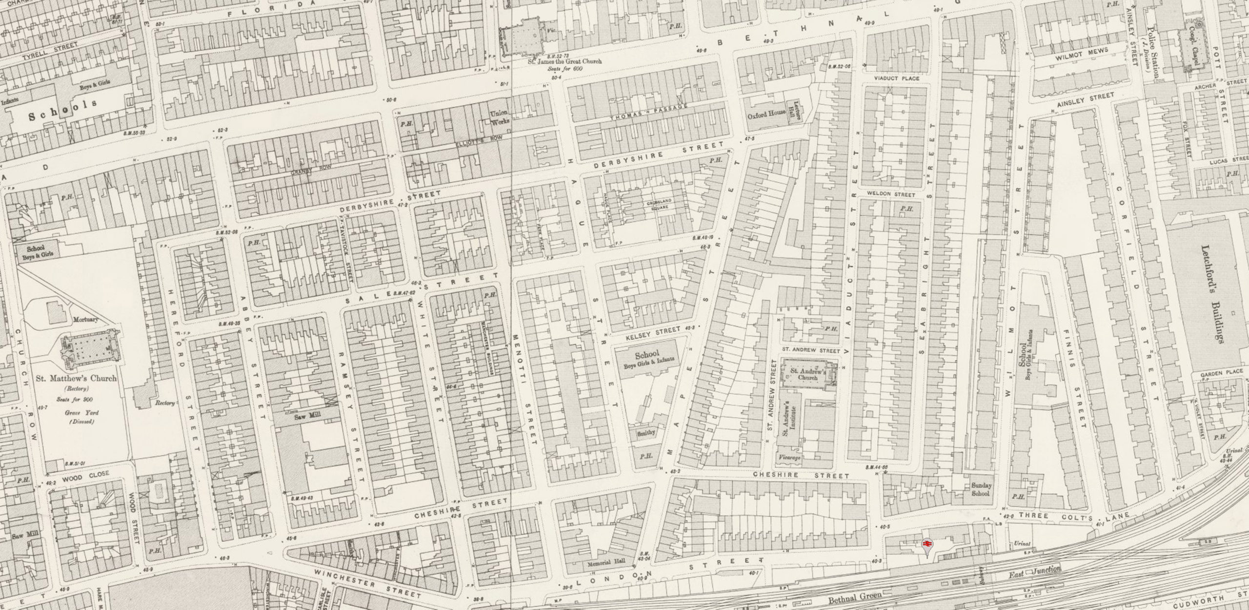
Map over the area in 1900 overlaid with the modern Weavers Fields park.
Much of the information I present here has been gathered over the past ten years from the web, oral histories from various people I’ve spoken to, along with visits to a number of archives. One of the most fascinating sources has been the Tower Hamlets Archive which holds many of the original County Council documents detailing the demolition of the houses and the conversion into a park.
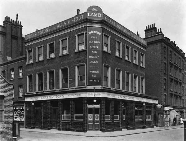
Ray Herrington lived with his family on the Waterlow Estate for the first 17 years of his life (from 1939 to 1956). His (step) grandmother was also the landlady of The Lamb pub. A few months ago Ray’s son Mark contacted me about talking with his father.
Ray’s life story would fill a book, and in our short conversation we managed to cover gangsters, street parties, bombs, nazi bashing and even the royal family. It was a real pleasure talking with Ray, his stories bring to life the real community spirit of The Estate. So grab a cup of tea and settle in, as Ray has a lot of memories and local knowledge to share !
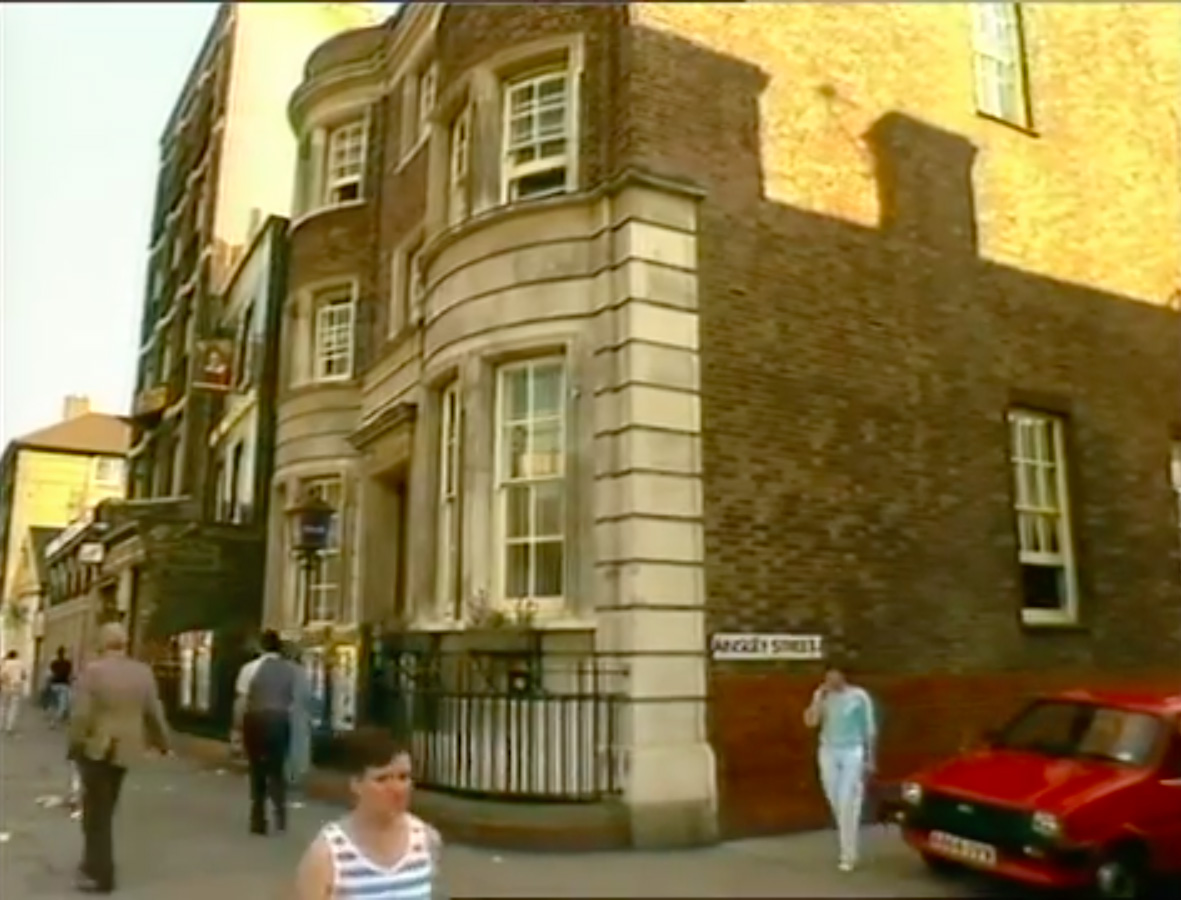
On the corner of Ainsley Street and Bethnal Green Rd sits an interesting building. Numbered 458 Bethnal Green Road, it is now the home of Providence Row Housing Association who work in the local area helping people at risk of homelessness. However it was once Bethnal Green Police Station.
Bethnal Green Police Station c1984
I’m unsure when the Police Station closed but I’ve managed to find two pieces of video footage showing the Station when it was up and running. The first seems to be some exterior library shots for Thames TV News from the 1980s.
The second is more extensive and is a collection of footage and photographs from someone who worked in CID. The video is captioned as being shot in 1991.
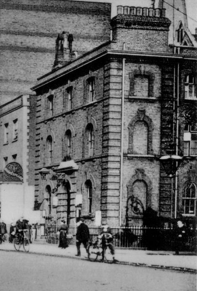
Historically the station was home to the J Division from around 1868 until 1933 when it fell under the H or Whitechapel division. There’s a fairly detailed breakdown of the history of the station on Bryn Elliot’s Police history site.
Bethnal Green Police Station c1907
There is also a mention in the London Echo of extra police patrols during the era of Jack the Ripper:
During the month of August, and up to the 8th instant, when Annie Chapman was killed, the following beats were covered by the men of the J Division quartered at Bethnal green, these forming what is known as the “Second Section night duty.” The first police constable would commence his two beats at Wilmot street, three Colt land, Cheshire street, Mape street, Bethnal green road, to Wilmot street, and the interior, this consisting of a few streets, courts, passages, &c. The second constable would cover Three Colt lane, Collingwood street, Darling row, Dog row, Whitechapel road, Brady street, to Three Colt lane, and the interior, this consisting of about twenty streets, courts, passages
Unfortunately I’ve been unable to find much more about the Police Station. I’d love to hear from anyone that knows about it’s history. Please get in touch via the comments.
The Waterlow Estate is the collective name for the Victorian blocks of flats lining Wilmot, Ainsley and Corfield Streets in Bethnal Green, London. It was constructed from 1869 to 1890 by Sir Sydney Waterlow’s Improved Industrial Dwellings Company. The two blocks nearest Bethnal Green Rd were built first, they would have been surrounded by the old weavers cottages which were eventually cleared as the road layout was progressively altered.
This quote gives a pretty clear picture of the order in which the Estate was constructed :
“The first blocks, in the north, opened in 1869. Homes for 72 families had been completed by 1871 and for another 130 by 1873 and 90 by 1875. The School Board for London purchased ½ a. between Wilmot and Finnis streets in 1873 and work began on 21 blocks (for 210 families) in the rest of Finnis Street in 1875 and on 12 blocks for 295 families in Corfield Road in 1878. The estate, later called Waterlow, complete by 1890 and the largest built by the company, was grim and canyon-like in appearance.”
The photograph below is taken from what is now Finnis street (then Pettits Walk) looking northwest towards Bethnal Green Rd.
Looking at the scaffolding I’m assuming it was taken during the construction of the first two blocks. It’s interesting to see that the blocks weren’t quite the shape they are now, with the top floor being set back a little.
I visited the Metropolitan Archive recently and found a number of original IIDC documents. I’ll post a few more of them in the future but this plan shows the layout of the estate on the completion of the first blocks.


Recent Comments