Documenting the history of the Waterlow Estate in Bethnal Green, East London. Comprising Wilmot, Corfield, Ainsley and Finnis Street the Waterlow Estate was built by the Improved Industrial Dwellings Company starting in 1869.

Category: 1970s

The lost streets of Weavers Fields, Part two – Demolition (1938 -1968)

There are three parts to this post, the first deals with the history of the area up until 1938, the second the clearing, demolition and eventual development of the park and the third and final part details each street in turn.

Demolition and renewal 1930-1960s

“This was taken from my grandparents window in Wilmot street, this overlooks Weavers field, looking towards Bethnal Green road, unsure of the year, but I would imagine pre war.” – Photograph kindly supplied by John McCarthy

“The whole of western Bethnal Green was scheduled for redevelopment under a 5-year plan for 1962-7, the southern part for industry, relieved by an open space called Weavers’ Fields around Mapes Street”

(from British History Online)

The Tower Hamlets archive holds a number of files filled with correspondence and drawings detailing the clearing and development of Weavers Fields. Much the information here is drawn from those files.

These are fascinating documents, filled with personal notes, annotations and asides. To recapture this era of local authority bureaucracy and drawing offices I’ve reproduced some of the actual documents. You can almost smell the tobacco filled council offices.

Continue reading

The lost streets of Weavers Fields, Part one – Growth (1700 – 1938)

Introduction

Since I started researching the Waterlow Estate I’ve unearthed lots of historical details and photographs of neighbouring Weavers Fields Park and the streets that are now buried beneath the grass.

There are three parts to this post, the first deals with the history of the area up until 1938, the second the clearing, demolition and eventual development of the park and the third and final part details each street in turn.

Looking south west over Weavers’ Fields – a comparison between then and now
Map over the area in 1900 overlaid with the modern Weavers Fields park.

Much of the information I present here has been gathered over the past ten years from the web, oral histories from various people I’ve spoken to, along with visits to a number of archives. One of the most fascinating sources has been the Tower Hamlets Archive which holds many of the original County Council documents detailing the demolition of the houses and the conversion into a park.

Continue reading

Waterlow Estate shops

I’ve always been fascinated by the old corner shop on Wilmot and Ainsley Street, especially as there did seem to be a business in there but they never seemed to be open. I had managed to find the planning application to switch the premises from use as a shop to an office back in 1998, but other than that the current occupier was a mystery. It was a great coincidence that I took a taxi a few months ago and got talking to the driver, it turned out that his brother was the current tenant running a sports shoe business.

1a Ainsley Street today. Photograph from John Mossell

Continue reading

The Greencoats Tenants Association

This is the second of three blog posts based on my email conversations with John Mossell of The Streets of Waterlow Estate and Bethnal Green Facebook group. The first post detailing his memories of the estate can be found here.

John has many memories of the Greencoats Tenants Association, an organisation I’d previously only known in relation to the rent strike in the early 1960s. The community spirit evident in the wide range of activities was forged in the residents struggle with their landlords Greencoat Properties Limited.

Before we get to John’s recollections I thought it’d be useful to detail the events of the strike which was held in response to the state of the buildings and the ever rising rent demands.

Continue reading

John Mossell – Memories of Corfield Street in the 1970s

Having a (very) niche obsession such as the Waterlow Estate means months of trawling the internet finding very little and then once in a while hitting the jackpot. It was in this vein that I recently happened across The Streets of Waterlow Estate and Bethnal Green Facebook group. I’m not sure why I’d never tried searching Facebook before but this group has proved to be a treasure trove of memories and photographs of the Estate.

A particular highlight was a link to a clip from Thames News in 1982 detailing the state of disrepair the buildings had fallen into by this time. You can see the clip here.

Continue reading

Photographs of Corfield and Finnis Street

In a recent post (Memories of growing up on Corfield Street) I mentioned that I have come across a number of photographs of Corfield Street before the blocks on Western side of the Street were demolished. As promised here are the photographs (with sources where available).

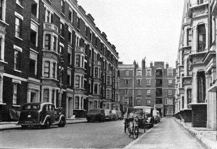
Corfield Street 1968.

Source: London and Middlesex Archaeological Society Journal Vol22 part1 (http://www.lamas.org.uk/transactions-archive/Vol%2022.pdf)

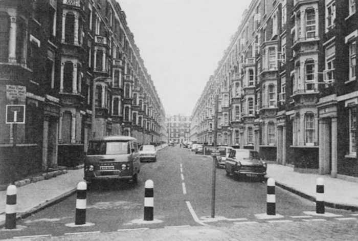
Corfield Street, looking North from Three Colts Lane. c1970

Source: unknown

The rest are a series of photographs by Andrew Scott which were posted on the Spitalfields Life website.

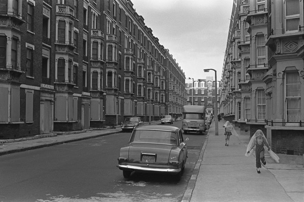
Looking north up Corfield Street. The blocks on the left are boarded up ready for demolition.

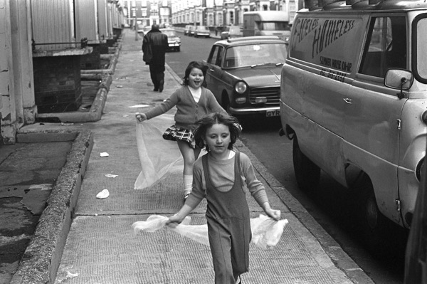
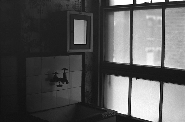
Inside one of the Corfield Street flats.

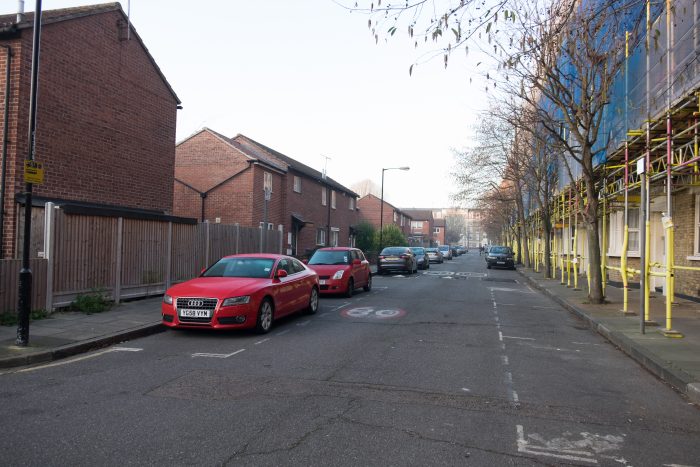
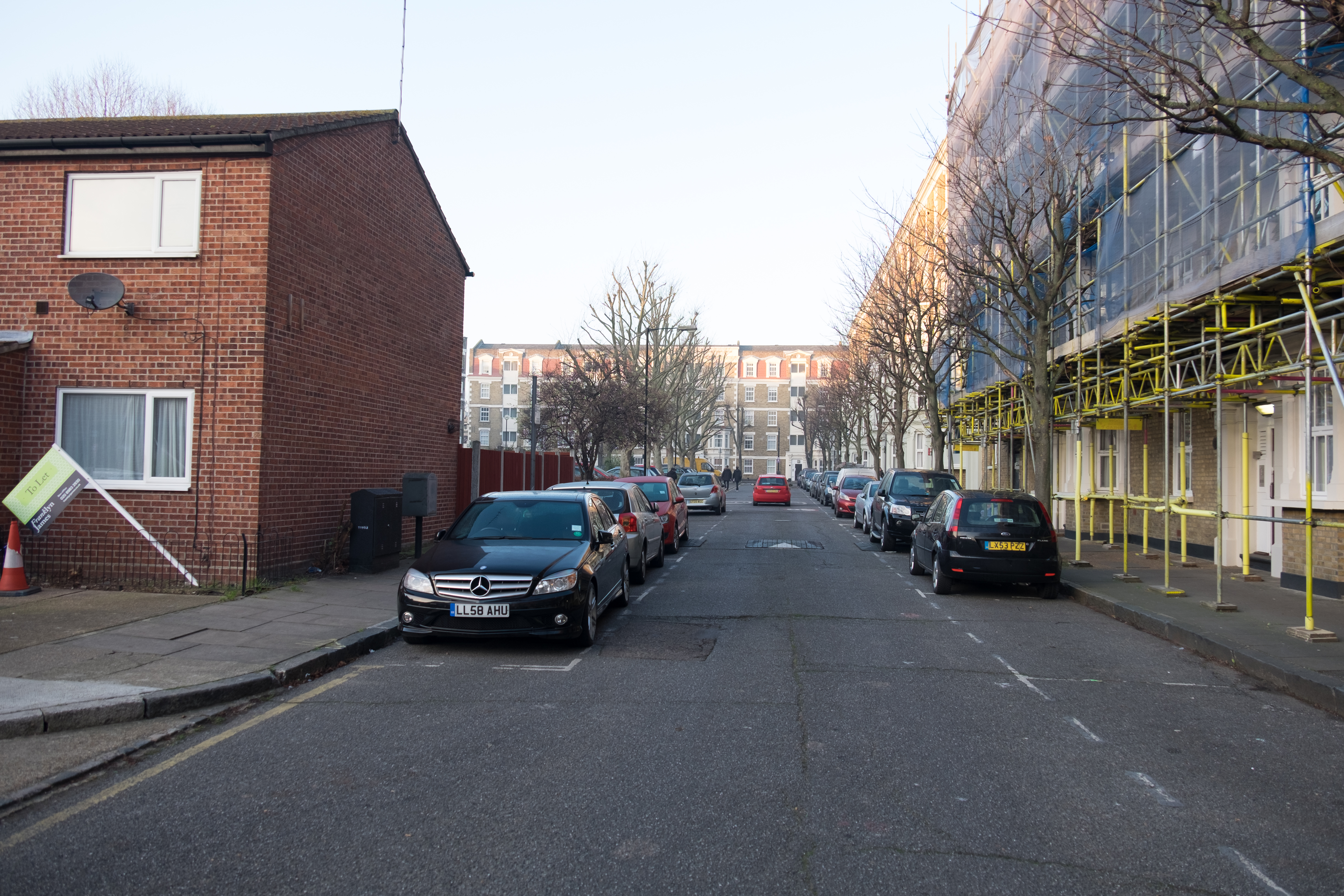
Below I’ve posted a couple of images showing Corfield Street today, both are taken looking South to North.

Returning now to Andrew Scott’s photographs, but this time showing Finnis Street.

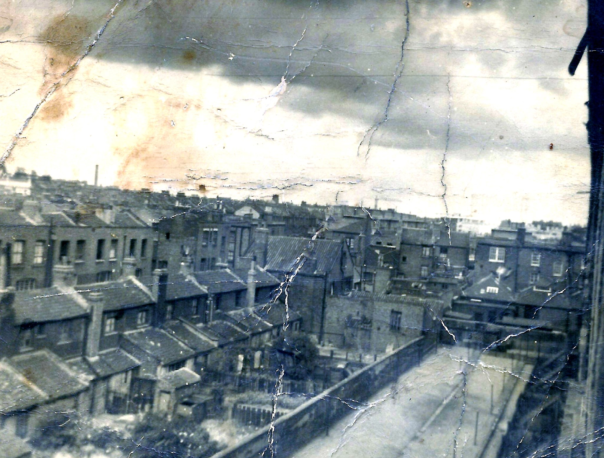
This is a guess but I think this photograph is taken from the rear of the now demolished Western side blocks on Corfield Street looking North West toward the rear of Finnis Street buildings with the Wilmot Street blocks in the far distance.

This is looking North towards Ainsley Street somewhere between Finnis and Corfield Street. By the looks of things this is during the demolition of the Corfield and Finnis Street blocks seen in the earlier photograph. You can also see a portion of what is now the Hague School on the left (this school used to be known as Wilmot Street Primary, and the Hague school was situated in the building which still stands on Mape Street). The blocks on the right are the rear of the now demolished western Corfield blocks.

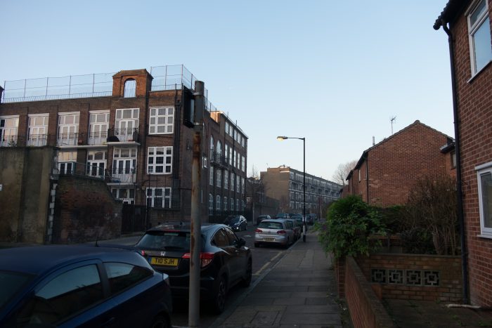
This is a similar angle looking up through Finnis Street today.

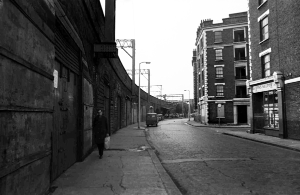
Finally an image of Three Colts Lane with Ron’s Saloon to the right (also mentioned here). This photograph is by Tony Hall and is featured on Spitalfields Life.

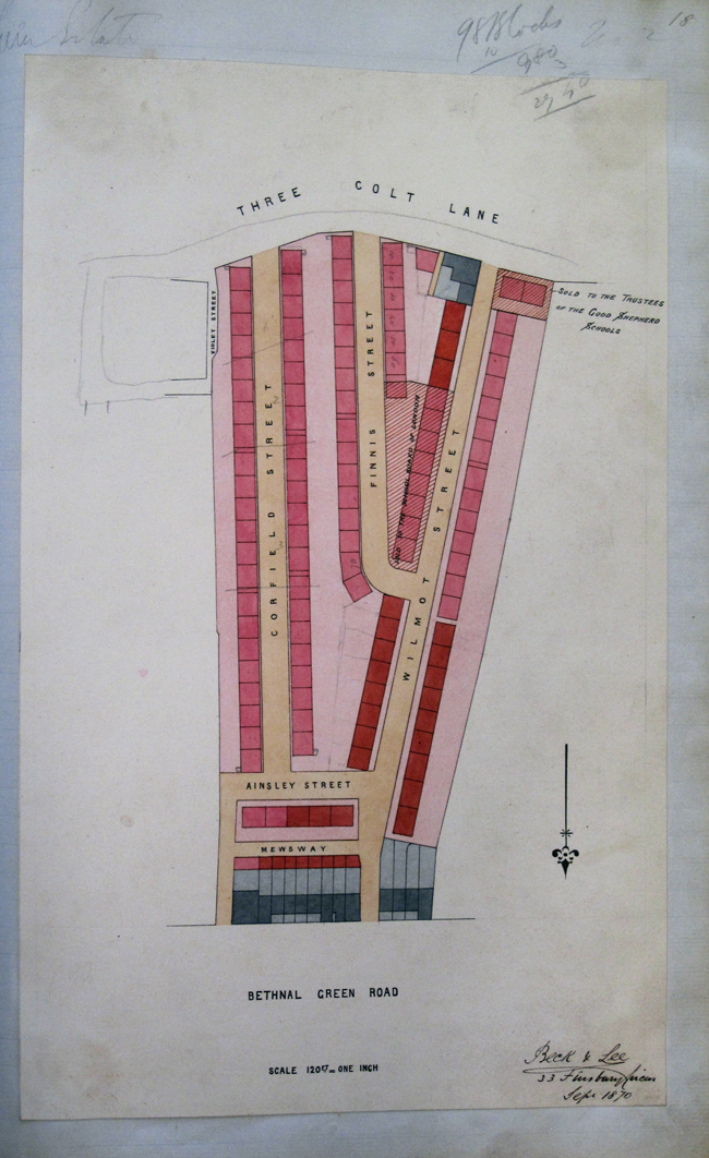
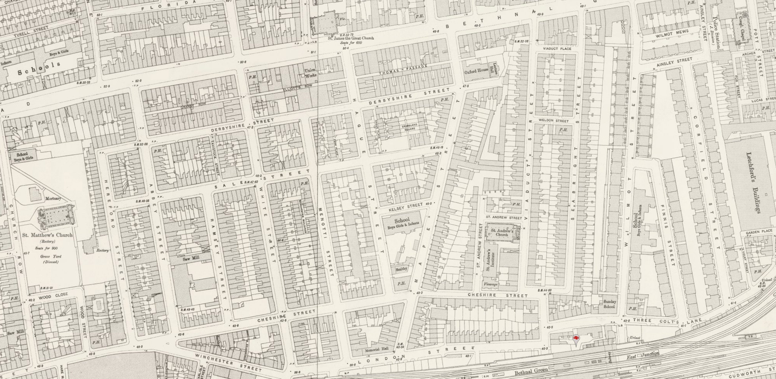
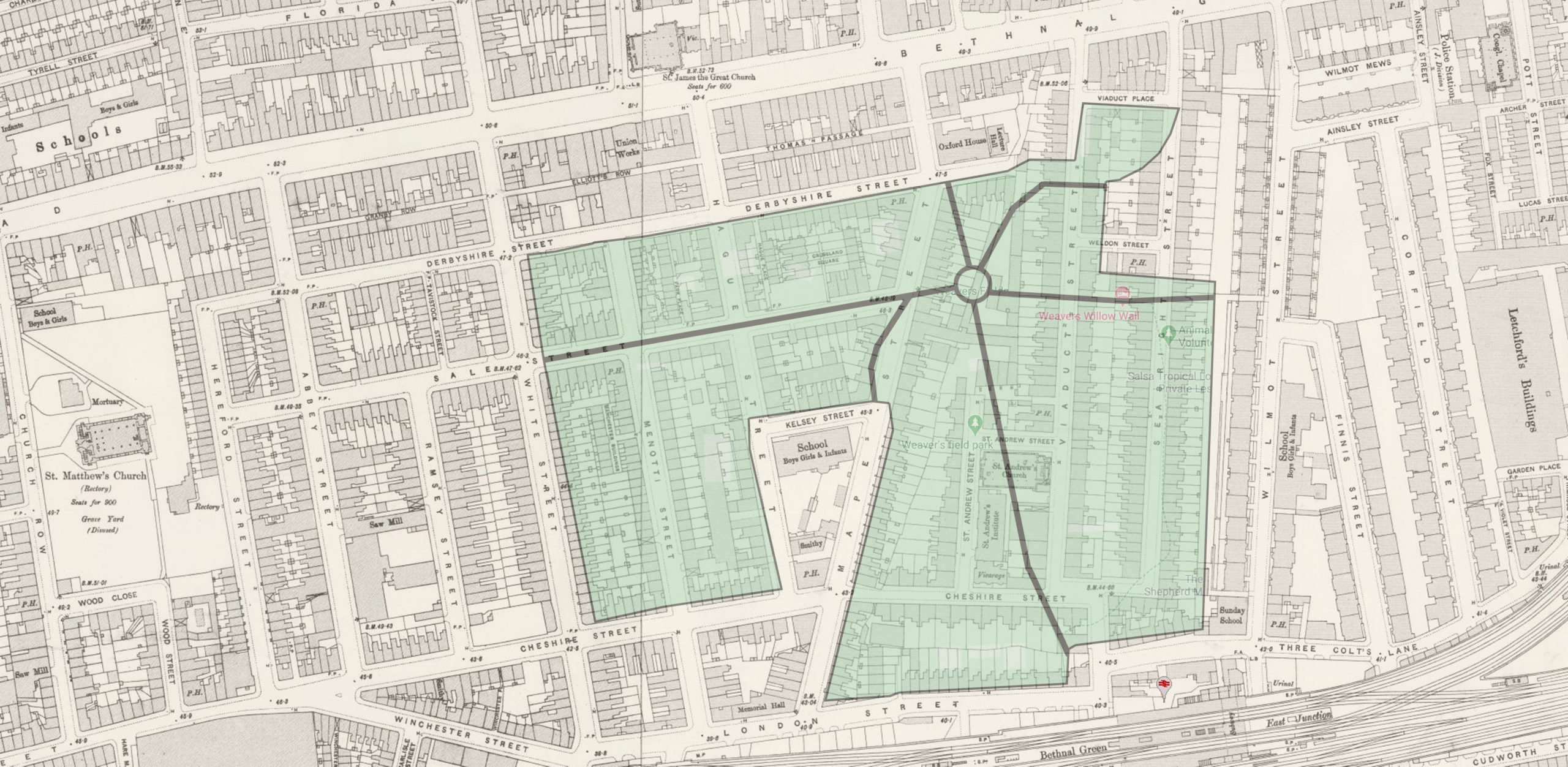
If you look at the plans below (from the Metropolitan Archive) you can get an idea of where these photographs could have been taken.