Since I started renewing and updating this website I’ve had some interesting comments from new readers. Very recently I was contacted by Lesley who wrote:
“I lived in Corfield Street from 1956 and the layout of the flats had changed from those shown on your archive pages. I could probably provide a rough outline of our flat if it is of interest. Also, by that time the top of the buildings were flat and provided a place for people who did not live on the ground floor (who had direct access to the communal yard between the buildings), to dry their washing in the fresh air. In the winter it was great fun to go up there and have a snowball fight across the street with kids on the roof of the opposite building.”
As one my the main goals of this site is to collect together stories and information from those who lived in the estate I was very keen to get in contact with her and find out more. Luckily Lesley was extremely generous with her time and agreed to answer some questions and even sent over some photographs and a plan of her flat as it was when she lived in it.
First here are the Photographs she sent me.
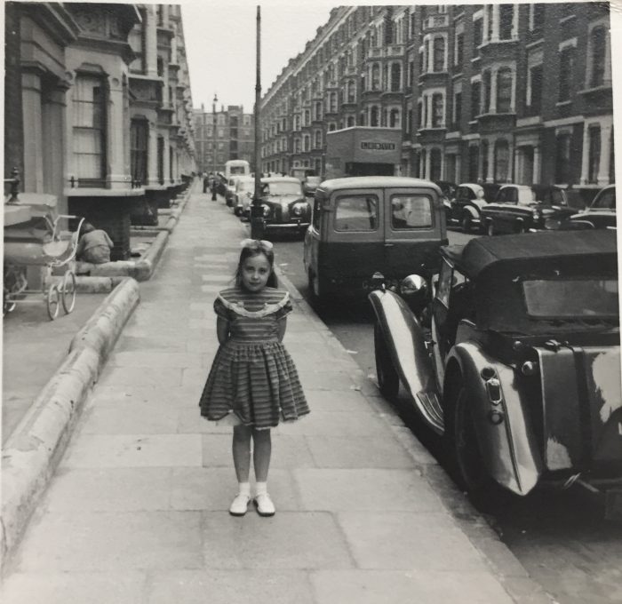
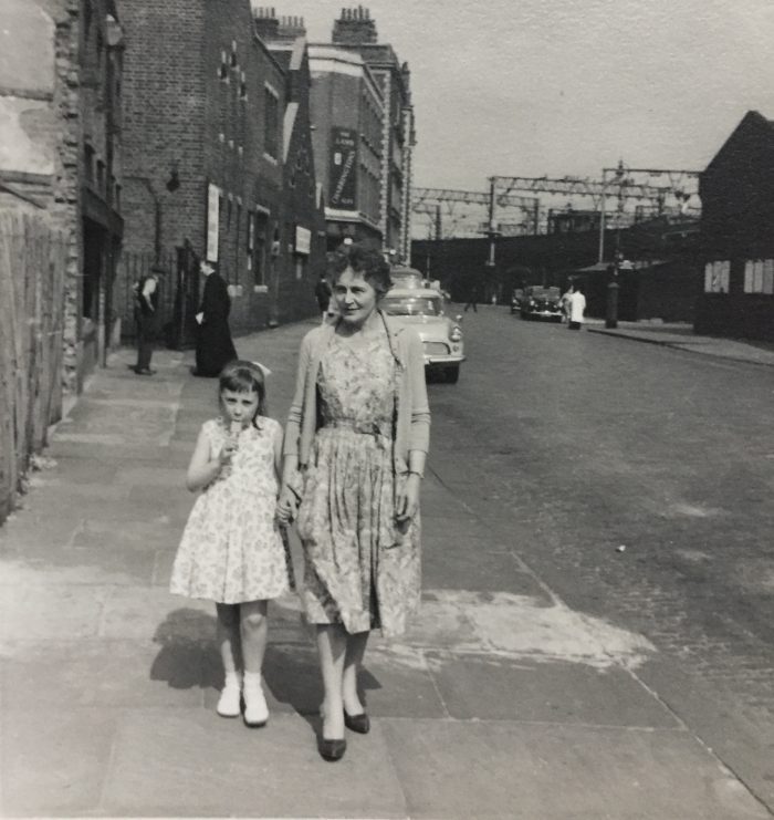
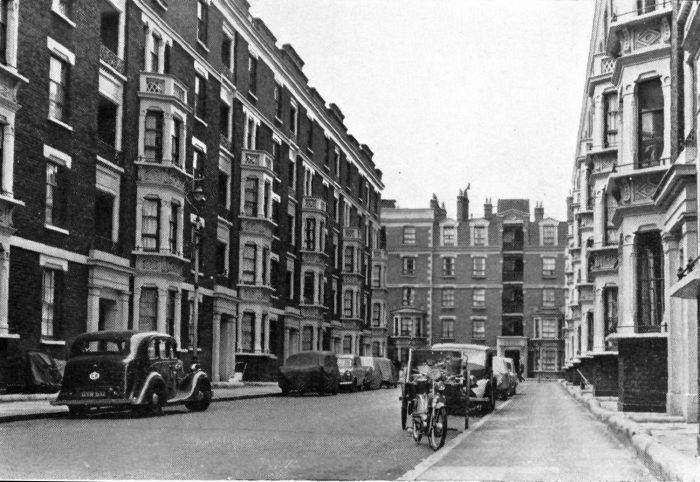
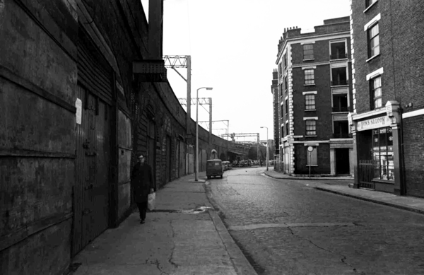
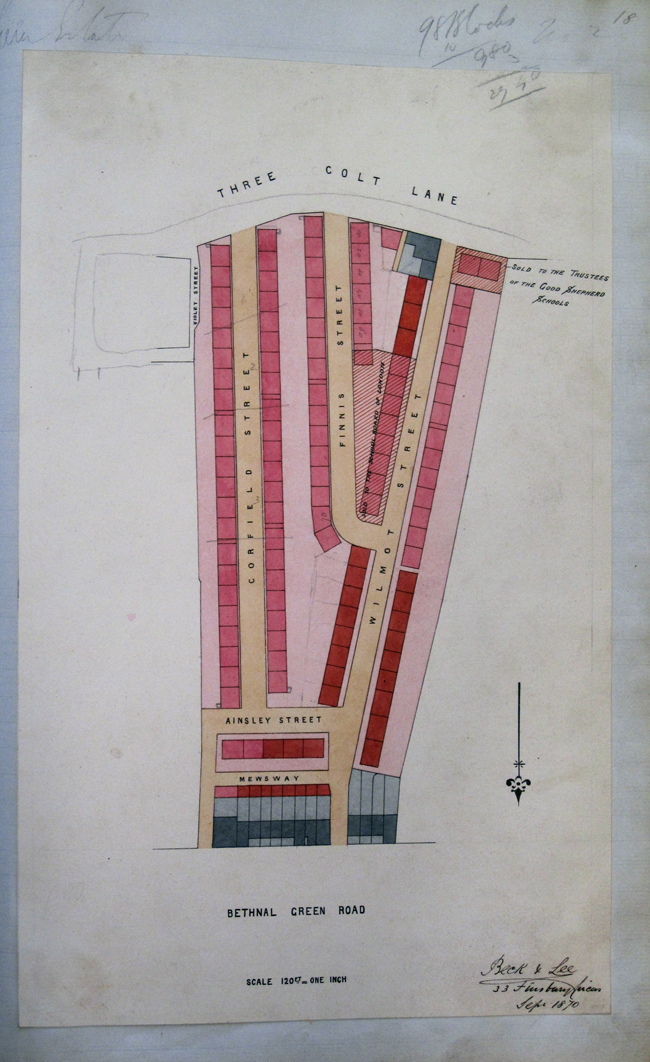
“Here is a copy of the best picture of Corfield Street I have found in my photo collection. I guess that it was taken about 1960. The photo is taken from the Three Colts Lane end looking along the street, with Ainsley Street buildings visible in the distance. The buildings on the left (that I lived in) have now been demolished as you know. The raised ‘boundaries’ around the bottom of the buildings originally housed iron railings which I guess were recycled during the war.”
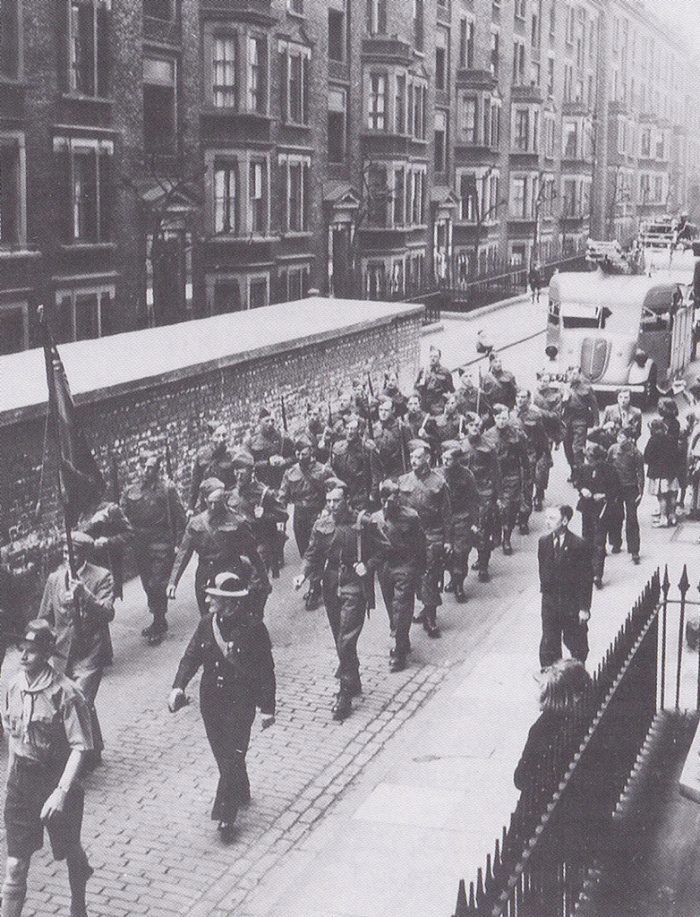
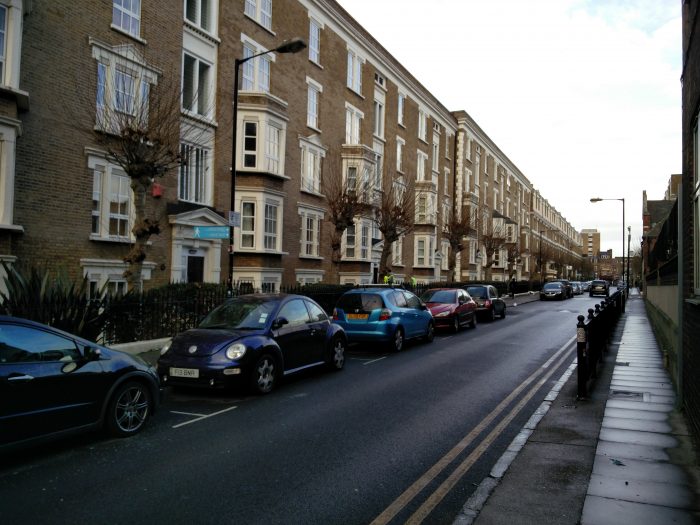
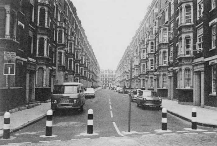
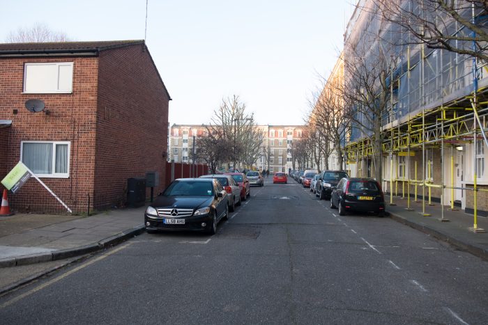
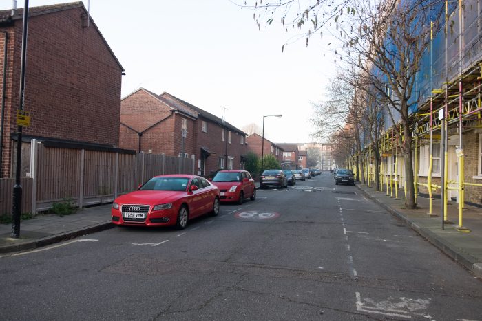
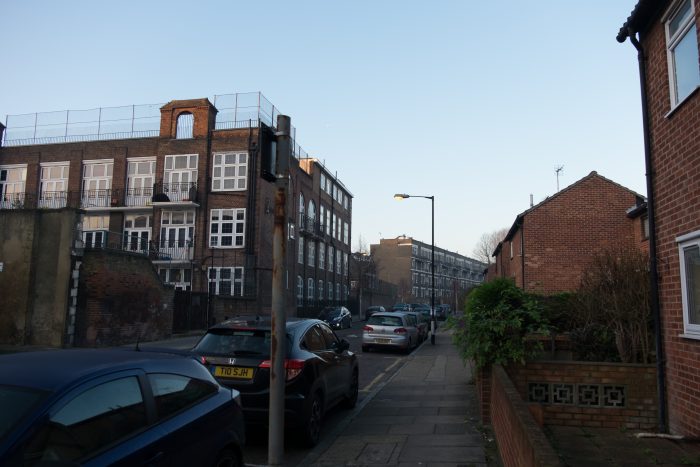
It’s interesting to see the blocks on the western side of Corfield Street, they’ve since been demolished to make space for the series of houses in Cul-de-sacs and the open garden space at the north end of Corfield Street. I have tracked down some more images of these blocks which you can see here.
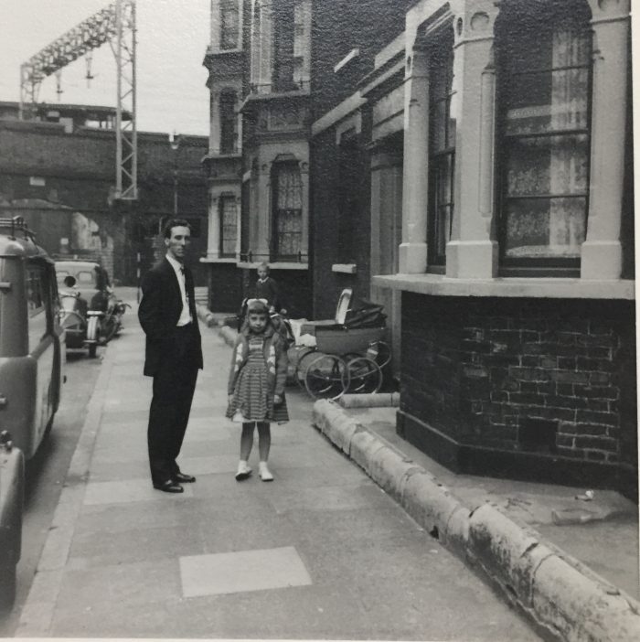
“This one is taken looking toward Three Colts Lane, at the same time as the original photo I sent through.”
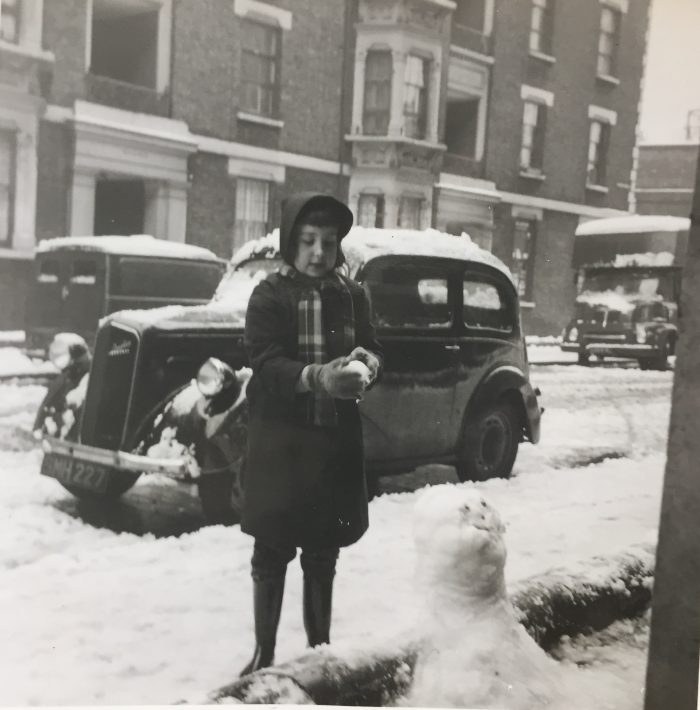
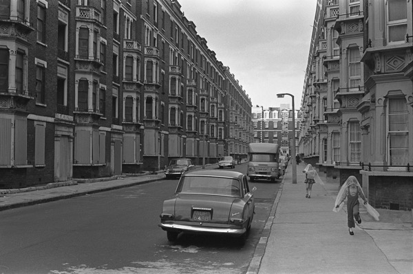
“I think this was taken on Boxing Day 1962 – the big snow”
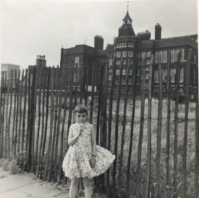
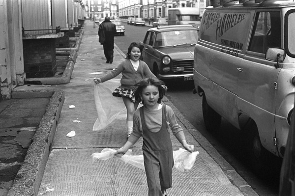
“Me with my primary school in the background (it is still there as a business centre I believe) – Hague Primary School. Weavers Field as is (directly behind me) was then just a bomb site.”
“The last photo is taken in Three Colts Lane at a similar place, looking back towards Wilmot Street. If I remember correctly, the building on the left (just beyond the priest) was a Barnado’s boys home at the time.”
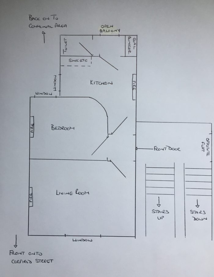
“I have also done a ‘rough’ outline of our flat in Corfield Street. We were on the side of the block without the bay window. I remember that at the entrance to the flats there were under stairs store rooms which you could rent to put bikes etc. in.”
I commented to Lesley that the layout seemed fairly similar to their current configuration and she replied that “one of my Uncles went to view the converted flats when they became available in the 60’s and he said that to make the bigger units, the joining wall (shown as the right hand side kitchen wall in my diagram) between the two flats had been removed to make one larger flat.”
Lesley was then very kind and spent time answering some questions I had:
How old were you when your family moved to Corfield Street ? .. where they from Bethnal Green originally ?
I was 2yrs old when my family moved to Corfield St.in 1956. My fathers family are all from the area, my mothers family was from Kent.
What did your family do ?
My father worked as a production controller in the ‘rag trade’ and was based in various places in London – Aldgate, Mortimer St (W.End) etc.. My mother worked as an accountant at Allen and Hanbury’s in Bethnal Green, just around the corner in Three Colts Lane! I remember that site quite well, the main building now being the Pill Box.
Did you have any relatives living nearby ?
Most of my fathers family also lived in Bethnal Green. One sister and one brother lived in Brady Street mansions in Brady Street with their respective partners. Brady St mansions looked fairly similar to Corfield Street but with a communal ‘front courtyard’ – I don’t know if they were built by the same company. Another brother lived in St Matthews Row (west of Weavers Field) and his mother and youngest brother both still lived in Barnard House in Ellsworth Street (opposite the Bethnal Green Road end of Ainsley Street). My paternal grandmothers brothers and sisters also lived in the area, having been born there. When I traced my family tree, I gathered my grandmother had never lived further than 2 miles from where she was born, except when evacuated during the war!
Can you describe your childhood when living in Corfield Street ?
I remember living in Corfield St with mostly fond memories. I had friends from school also living in the street and we used to play outside together when our parents allowed which was usually for a couple of hours after school. At that time Corfield St was designated a ‘play street’ (there were signs at both end of the street) which meant that through traffic was prohibited. We rode our bikes and played football or cricket with the other kids in the street. Violet Street was accessible by an arch between the buildings and was a pedestrian cut through. Someone had drawn stumps on the wall at the end with chalk and it was a favourite place to play cricket. The security guards in the entrance lodge at A&H were forever retrieving balls for us! As we got older we were allowed to stray further afield on our bikes but only to explore the surrounding area of the Waterlow Buildings. On Sundays the ‘winkle man’ used to come around, pushing his barrow ladened with shell fish – winkles, whelks, prawns. I also remember the ‘Corona man’ came once a week – this time with a lorry full of fizzy pop. Of course there was always the rag and bone man.
Did you go to school locally ?
I went to Hague Primary School (Mape Street) until I was 11yrs old.
Are there any particular local shops or pubs that you remember ?
I always remember Ron’s the barber on the corner of Corfield St and Three Colts Lane and the 2 shops (a newsagent and a grocers) as previously described between Finnis and Wilmot Street. I think the now Good Shepherd Mission was a Barnado’s Home at that time. There was also a pub on Three Colts Lane, but I’m not sure what it was called, being too young to notice – it might have been the Lamb on the corner of Wilmot St but I can remember another too – which was probably The Duke of Wellington, just around the corner next to A&H. I remember the Police Station on Bethnal Green road, The Shakespeare pub next door (where a neighbour held their post marriage festivities) and the shop on the corner of Wilmot St which is Furniture Xpress now was a furniture shop then too. Obviously Kelly’s pie and eel shop was a staple and we used to go to the Brick Lane to purchase bagels from the many jewish bakers in the area. There used to be many market barrows running along the southern side of the Bethnal Green road from Wilmot St to Vallance Rd selling groceries, fruit and sundries. There was a fish stall (outside of Kelly’s I think) which sold fresh eels, which would be sleepily slithering around on ice. There’s an old story (no idea if its actually true) to the effect that one day an eel escaped and was making its way across the Bethnal Green road. A woman waiting at the stall shouted out to the stall holder ‘quick, save that eel, it’s just about to be run over by a bus!’ The stallholder stopped the bus just in time, retrieved the eel and returned to his stall. The woman who had shouted out then said ‘I’ll have that one’ at which point the fishmonger chopped the head and tail off, split it, removed the guts and wrapped it up and sold it to her.
Do you remember the buildings themselves ? .. were they in good condition at that time ?
At my time in Corfield St (1956-1966) I thought the buildings were nice and in good shape, looked after proudly by the residents. People took it in turn to wash down the communal stairs and I don’t remember there being any rubbish around, even in the alleyways. There was no feeling of ‘slum’ or ‘underpriviledged’ and most parents were able to pay for their kids school dinners. In those days if you couldn’t afford to pay for dinner, you had a different colour dinner card, so it was pretty obvious who was really poor.
Do you know if they had been altered much from their original Victorian state ?
I was far too young to realise the provenance of the buildings.
Was the roof pitched or flat when you lived there ? .. were you able to gain access to the roofs ?
The building roofs were communal (ran the length of each block) and flat. They were accessed from the top floor of the stairway which ran up to an access door which were mounted on the side of a raised rectangle. As I said previously, when the snow came we had snowball fights across the road from there with the kids from the opposite side of the road.
What state was Weavers’ Fields in at this time ? .. where any of the old cottages still present ?
Weavers Field was a bomb site in those days and wasn’t developed until after my time I think. There were no buildings there to my recollection.
Do any local characters or stories spring to mind ?
The east end was full of characters in those days, but none in my street that I particularly remember. The Krays were pretty active at that time of course and Vallance Road was not far away. Interestingly they seemed to be pretty well respected in the area by the ‘populus’ (and not from a fear of them) – as they were seen to ‘look after their own’. I remember the shooting happening in the Blind Beggar and local rumours were that some of the Krays ‘victims’ were disposed of in the concrete pillars of the then under construction Bow flyover. It will be interesting to see if this urban legend is proved correct if the flyover is ever removed!
I have found some information that the Improved Industrial Dwellings Co. changed its name to Greencoat Properties in 1962, it seems that soon after this questions were asked about the condition of the buildings and the local Authority stepped in and took them over very soon after. Here’s a quote:
“During the Twentieth century, Waterlow’s buildings, were sorely neglected. They had moved from the management of the Improved Industrial Dwellings Company to Greencoat Properties Ltd. By the early 1960s these flat were described as ‘malodorous litter dens’. In 1962 Greencoat threatened tenants on the nearby Waterlow estate with doubled rents or eviction, which led to a rent strike. The result was the purchase of all former IIDCo properties in the area by Tower Hamlets council in the 1960s.”
Do you know anything about this ?
I do not remember anything about a rent strike (I wasn’t paying it of course) and the description of ‘malodorous litter dens’ does not square with my memories of the place up until 1966.
When did you move away ?, did you stay in the Bethnal Green area ?
We moved to newer rented accommodation in South London in 1966 (before the world cup).
Have you been back and visited since you left ?
Yes, I have been back a couple of times while researching my family tree.
Lastly, I’ve heard a rumour about a man who lived on Wilmot Street in the 1960s who won the pools. Apparently he paid the rent of everyone nearby .. I don’t suppose you ever heard this story ?
I definitely remember a man in Wilmot Street winning the pools. I think he may have been widowed (or divorced) as I think that only his daughter lived with him. It was certainly big news at the time – not sure how much he won but something like £2k or £5k comes to mind. It was a fortune in those days. I cannot confirm the story that he paid the locals rent though.
I want to thank Lesley for taking the time to find and send over these photographs and answer all my questions so thoroughly. I’d also like to thank her for giving me permission to share them here. This is precisely what I had hoped this site would become – a place to share stories and piece together the story of the Estate over the years.
If you or someone you know lived on the Waterlow Estate at any point I would absolutely love to hear from you. Please drop a line in the comments and I’ll be in touch.


Recent Comments